You are here: Home > Network List > TA - USArray Transportable Network (new EarthScope stations) Stations List
> Station N23A Red Feather Lakes, CO, USA > Earthquake Result Viewer
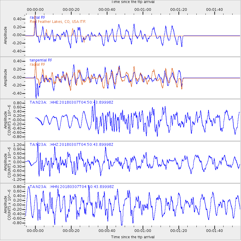
N23A Red Feather Lakes, CO, USA - Earthquake Result Viewer
*The percent match for this event was below the threshold and hence no stack was calculated.
| Earthquake location: |
East Of Kuril Islands |
| Earthquake latitude/longitude: |
45.8/152.3 |
| Earthquake time(UTC): |
2018/03/07 (066) 04:40:12 GMT |
| Earthquake Depth: |
29 km |
| Earthquake Magnitude: |
5.8 Mww |
| Earthquake Catalog/Contributor: |
NEIC PDE/us |
|
| Network: |
TA USArray Transportable Network (new EarthScope stations) |
| Station: |
N23A Red Feather Lakes, CO, USA |
| Lat/Lon: |
40.89 N/105.94 W |
| Elevation: |
2458 m |
|
| Distance: |
69.0 deg |
| Az: |
52.643 deg |
| Baz: |
312.846 deg |
| Ray Param: |
$rayparam |
*The percent match for this event was below the threshold and hence was not used in the summary stack. |
|
| Radial Match: |
50.66783 % |
| Radial Bump: |
400 |
| Transverse Match: |
63.124763 % |
| Transverse Bump: |
400 |
| SOD ConfigId: |
13570011 |
| Insert Time: |
2019-04-29 22:25:15.292 +0000 |
| GWidth: |
2.5 |
| Max Bumps: |
400 |
| Tol: |
0.001 |
|
Signal To Noise
| Channel | StoN | STA | LTA |
| TA:N23A: :HHZ:20180307T04:50:43.89998Z | 2.2044983 | 5.0002177E-7 | 2.2681887E-7 |
| TA:N23A: :HHN:20180307T04:50:43.89998Z | 1.2644022 | 3.93678E-7 | 3.1135505E-7 |
| TA:N23A: :HHE:20180307T04:50:43.89998Z | 2.212466 | 4.0601043E-7 | 1.8351035E-7 |
| Arrivals |
| Ps | |
| PpPs | |
| PsPs/PpSs | |


