You are here: Home > Network List > TA - USArray Transportable Network (new EarthScope stations) Stations List
> Station R32K Eaglecrest, AK, USA > Earthquake Result Viewer
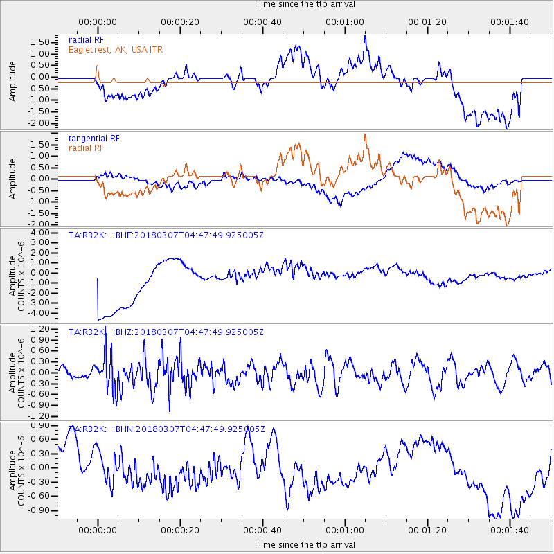
R32K Eaglecrest, AK, USA - Earthquake Result Viewer
*The percent match for this event was below the threshold and hence no stack was calculated.
| Earthquake location: |
East Of Kuril Islands |
| Earthquake latitude/longitude: |
45.8/152.3 |
| Earthquake time(UTC): |
2018/03/07 (066) 04:40:12 GMT |
| Earthquake Depth: |
29 km |
| Earthquake Magnitude: |
5.8 Mww |
| Earthquake Catalog/Contributor: |
NEIC PDE/us |
|
| Network: |
TA USArray Transportable Network (new EarthScope stations) |
| Station: |
R32K Eaglecrest, AK, USA |
| Lat/Lon: |
58.27 N/134.52 W |
| Elevation: |
386 m |
|
| Distance: |
44.5 deg |
| Az: |
46.238 deg |
| Baz: |
287.112 deg |
| Ray Param: |
$rayparam |
*The percent match for this event was below the threshold and hence was not used in the summary stack. |
|
| Radial Match: |
29.484552 % |
| Radial Bump: |
400 |
| Transverse Match: |
48.84627 % |
| Transverse Bump: |
400 |
| SOD ConfigId: |
13570011 |
| Insert Time: |
2019-04-29 22:25:36.468 +0000 |
| GWidth: |
2.5 |
| Max Bumps: |
400 |
| Tol: |
0.001 |
|
Signal To Noise
| Channel | StoN | STA | LTA |
| TA:R32K: :BHZ:20180307T04:47:49.925005Z | 3.195074 | 4.8622917E-7 | 1.5218087E-7 |
| TA:R32K: :BHN:20180307T04:47:49.925005Z | 0.52118 | 3.3263208E-7 | 6.382288E-7 |
| TA:R32K: :BHE:20180307T04:47:49.925005Z | 0.42838788 | 9.413137E-7 | 2.1973399E-6 |
| Arrivals |
| Ps | |
| PpPs | |
| PsPs/PpSs | |


