You are here: Home > Network List > TA - USArray Transportable Network (new EarthScope stations) Stations List
> Station T25A Trinidad, CO, USA > Earthquake Result Viewer
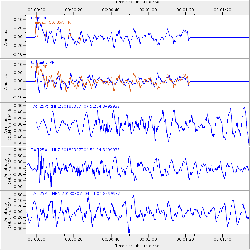
T25A Trinidad, CO, USA - Earthquake Result Viewer
*The percent match for this event was below the threshold and hence no stack was calculated.
| Earthquake location: |
East Of Kuril Islands |
| Earthquake latitude/longitude: |
45.8/152.3 |
| Earthquake time(UTC): |
2018/03/07 (066) 04:40:12 GMT |
| Earthquake Depth: |
29 km |
| Earthquake Magnitude: |
5.8 Mww |
| Earthquake Catalog/Contributor: |
NEIC PDE/us |
|
| Network: |
TA USArray Transportable Network (new EarthScope stations) |
| Station: |
T25A Trinidad, CO, USA |
| Lat/Lon: |
37.14 N/104.41 W |
| Elevation: |
2017 m |
|
| Distance: |
72.5 deg |
| Az: |
54.643 deg |
| Baz: |
314.468 deg |
| Ray Param: |
$rayparam |
*The percent match for this event was below the threshold and hence was not used in the summary stack. |
|
| Radial Match: |
51.991566 % |
| Radial Bump: |
400 |
| Transverse Match: |
62.2533 % |
| Transverse Bump: |
400 |
| SOD ConfigId: |
13570011 |
| Insert Time: |
2019-04-29 22:25:41.072 +0000 |
| GWidth: |
2.5 |
| Max Bumps: |
400 |
| Tol: |
0.001 |
|
Signal To Noise
| Channel | StoN | STA | LTA |
| TA:T25A: :HHZ:20180307T04:51:04.849993Z | 2.7866106 | 3.9617132E-7 | 1.4216961E-7 |
| TA:T25A: :HHN:20180307T04:51:04.849993Z | 1.004845 | 2.2555729E-7 | 2.2446973E-7 |
| TA:T25A: :HHE:20180307T04:51:04.849993Z | 1.3678037 | 2.3044937E-7 | 1.6848134E-7 |
| Arrivals |
| Ps | |
| PpPs | |
| PsPs/PpSs | |


