You are here: Home > Network List > UW - Pacific Northwest Regional Seismic Network Stations List
> Station FISH Seaside, OR, USA > Earthquake Result Viewer
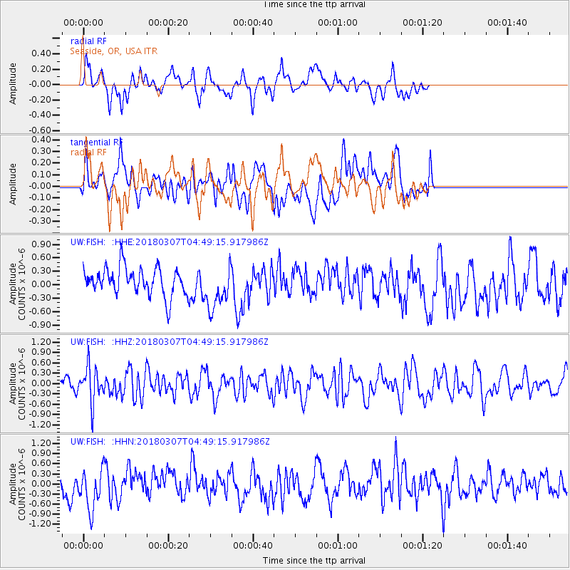
FISH Seaside, OR, USA - Earthquake Result Viewer
*The percent match for this event was below the threshold and hence no stack was calculated.
| Earthquake location: |
East Of Kuril Islands |
| Earthquake latitude/longitude: |
45.8/152.3 |
| Earthquake time(UTC): |
2018/03/07 (066) 04:40:12 GMT |
| Earthquake Depth: |
29 km |
| Earthquake Magnitude: |
5.8 Mww |
| Earthquake Catalog/Contributor: |
NEIC PDE/us |
|
| Network: |
UW Pacific Northwest Regional Seismic Network |
| Station: |
FISH Seaside, OR, USA |
| Lat/Lon: |
45.93 N/123.56 W |
| Elevation: |
325 m |
|
| Distance: |
55.8 deg |
| Az: |
57.055 deg |
| Baz: |
302.777 deg |
| Ray Param: |
$rayparam |
*The percent match for this event was below the threshold and hence was not used in the summary stack. |
|
| Radial Match: |
59.176243 % |
| Radial Bump: |
400 |
| Transverse Match: |
38.19981 % |
| Transverse Bump: |
400 |
| SOD ConfigId: |
13570011 |
| Insert Time: |
2019-04-29 22:26:39.426 +0000 |
| GWidth: |
2.5 |
| Max Bumps: |
400 |
| Tol: |
0.001 |
|
Signal To Noise
| Channel | StoN | STA | LTA |
| UW:FISH: :HHZ:20180307T04:49:15.917986Z | 2.921831 | 5.330703E-7 | 1.8244394E-7 |
| UW:FISH: :HHN:20180307T04:49:15.917986Z | 2.068229 | 6.278604E-7 | 3.0357393E-7 |
| UW:FISH: :HHE:20180307T04:49:15.917986Z | 1.6391423 | 5.0044486E-7 | 3.05309E-7 |
| Arrivals |
| Ps | |
| PpPs | |
| PsPs/PpSs | |


