You are here: Home > Network List > TA - USArray Transportable Network (new EarthScope stations) Stations List
> Station B15A Bradely Ranch, Valier, MT, USA > Earthquake Result Viewer
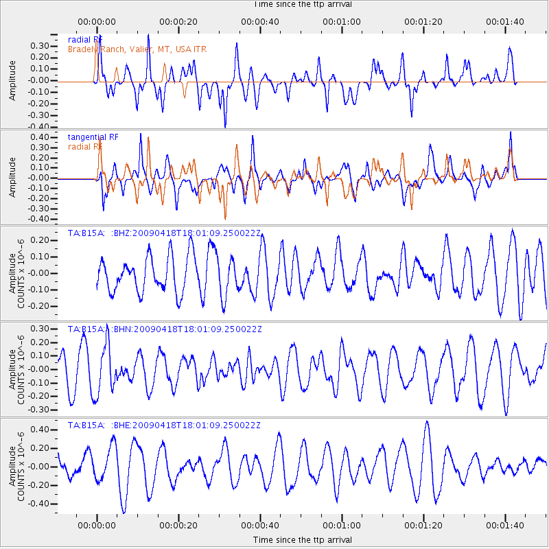
B15A Bradely Ranch, Valier, MT, USA - Earthquake Result Viewer
*The percent match for this event was below the threshold and hence no stack was calculated.
| Earthquake location: |
Fiji Islands Region |
| Earthquake latitude/longitude: |
-20.6/-178.5 |
| Earthquake time(UTC): |
2009/04/18 (108) 17:49:39 GMT |
| Earthquake Depth: |
566 km |
| Earthquake Magnitude: |
5.7 MW, 5.0 MB, 5.7 MW |
| Earthquake Catalog/Contributor: |
WHDF/NEIC |
|
| Network: |
TA USArray Transportable Network (new EarthScope stations) |
| Station: |
B15A Bradely Ranch, Valier, MT, USA |
| Lat/Lon: |
48.31 N/112.56 W |
| Elevation: |
1222 m |
|
| Distance: |
90.3 deg |
| Az: |
37.551 deg |
| Baz: |
238.787 deg |
| Ray Param: |
$rayparam |
*The percent match for this event was below the threshold and hence was not used in the summary stack. |
|
| Radial Match: |
71.062805 % |
| Radial Bump: |
400 |
| Transverse Match: |
59.000458 % |
| Transverse Bump: |
400 |
| SOD ConfigId: |
2658 |
| Insert Time: |
2010-03-06 09:42:29.955 +0000 |
| GWidth: |
2.5 |
| Max Bumps: |
400 |
| Tol: |
0.001 |
|
Signal To Noise
| Channel | StoN | STA | LTA |
| TA:B15A: :BHN:20090418T18:01:09.250022Z | 1.9317007 | 1.8419307E-7 | 9.5352796E-8 |
| TA:B15A: :BHE:20090418T18:01:09.250022Z | 1.2784628 | 1.8928436E-7 | 1.4805622E-7 |
| TA:B15A: :BHZ:20090418T18:01:09.250022Z | 1.1361991 | 1.199603E-7 | 1.05580355E-7 |
| Arrivals |
| Ps | |
| PpPs | |
| PsPs/PpSs | |


