You are here: Home > Network List > TA - USArray Transportable Network (new EarthScope stations) Stations List
> Station C16K Lisburne Hills, AK, USA > Earthquake Result Viewer
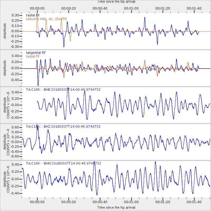
C16K Lisburne Hills, AK, USA - Earthquake Result Viewer
*The percent match for this event was below the threshold and hence no stack was calculated.
| Earthquake location: |
New Britain Region, P.N.G. |
| Earthquake latitude/longitude: |
-5.4/151.4 |
| Earthquake time(UTC): |
2018/03/07 (066) 13:49:17 GMT |
| Earthquake Depth: |
56 km |
| Earthquake Magnitude: |
5.6 Mww |
| Earthquake Catalog/Contributor: |
NEIC PDE/us |
|
| Network: |
TA USArray Transportable Network (new EarthScope stations) |
| Station: |
C16K Lisburne Hills, AK, USA |
| Lat/Lon: |
68.27 N/165.34 W |
| Elevation: |
102 m |
|
| Distance: |
79.5 deg |
| Az: |
15.041 deg |
| Baz: |
223.943 deg |
| Ray Param: |
$rayparam |
*The percent match for this event was below the threshold and hence was not used in the summary stack. |
|
| Radial Match: |
54.28606 % |
| Radial Bump: |
304 |
| Transverse Match: |
57.38602 % |
| Transverse Bump: |
365 |
| SOD ConfigId: |
13570011 |
| Insert Time: |
2019-04-29 22:31:49.600 +0000 |
| GWidth: |
2.5 |
| Max Bumps: |
400 |
| Tol: |
0.001 |
|
Signal To Noise
| Channel | StoN | STA | LTA |
| TA:C16K: :BHZ:20180307T14:00:46.974973Z | 3.2497544 | 3.5023544E-7 | 1.0777289E-7 |
| TA:C16K: :BHN:20180307T14:00:46.974973Z | 0.8487593 | 1.4645559E-7 | 1.7255256E-7 |
| TA:C16K: :BHE:20180307T14:00:46.974973Z | 1.523899 | 2.7900109E-7 | 1.8308371E-7 |
| Arrivals |
| Ps | |
| PpPs | |
| PsPs/PpSs | |


