You are here: Home > Network List > UW - Pacific Northwest Regional Seismic Network Stations List
> Station LEBA Lebam, WA, USA > Earthquake Result Viewer
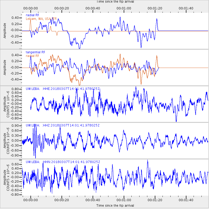
LEBA Lebam, WA, USA - Earthquake Result Viewer
*The percent match for this event was below the threshold and hence no stack was calculated.
| Earthquake location: |
New Britain Region, P.N.G. |
| Earthquake latitude/longitude: |
-5.4/151.4 |
| Earthquake time(UTC): |
2018/03/07 (066) 13:49:17 GMT |
| Earthquake Depth: |
56 km |
| Earthquake Magnitude: |
5.6 Mww |
| Earthquake Catalog/Contributor: |
NEIC PDE/us |
|
| Network: |
UW Pacific Northwest Regional Seismic Network |
| Station: |
LEBA Lebam, WA, USA |
| Lat/Lon: |
46.55 N/123.56 W |
| Elevation: |
73 m |
|
| Distance: |
90.5 deg |
| Az: |
43.444 deg |
| Baz: |
262.694 deg |
| Ray Param: |
$rayparam |
*The percent match for this event was below the threshold and hence was not used in the summary stack. |
|
| Radial Match: |
60.185173 % |
| Radial Bump: |
400 |
| Transverse Match: |
51.110977 % |
| Transverse Bump: |
400 |
| SOD ConfigId: |
13570011 |
| Insert Time: |
2019-04-29 22:33:08.990 +0000 |
| GWidth: |
2.5 |
| Max Bumps: |
400 |
| Tol: |
0.001 |
|
Signal To Noise
| Channel | StoN | STA | LTA |
| UW:LEBA: :HHZ:20180307T14:01:41.978025Z | 2.6624405 | 4.5696112E-7 | 1.7163242E-7 |
| UW:LEBA: :HHN:20180307T14:01:41.978025Z | 0.62870216 | 1.9958573E-7 | 3.174567E-7 |
| UW:LEBA: :HHE:20180307T14:01:41.978025Z | 1.931814 | 4.2447436E-7 | 2.1972839E-7 |
| Arrivals |
| Ps | |
| PpPs | |
| PsPs/PpSs | |


