You are here: Home > Network List > TA - USArray Transportable Network (new EarthScope stations) Stations List
> Station B15A Bradely Ranch, Valier, MT, USA > Earthquake Result Viewer
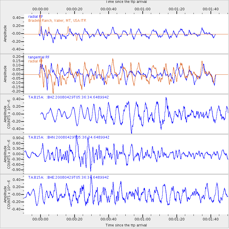
B15A Bradely Ranch, Valier, MT, USA - Earthquake Result Viewer
*The percent match for this event was below the threshold and hence no stack was calculated.
| Earthquake location: |
Hokkaido, Japan Region |
| Earthquake latitude/longitude: |
41.5/142.0 |
| Earthquake time(UTC): |
2008/04/29 (120) 05:26:04 GMT |
| Earthquake Depth: |
47 km |
| Earthquake Magnitude: |
5.5 MB, 5.2 MS, 5.8 MW, 5.8 MW |
| Earthquake Catalog/Contributor: |
WHDF/NEIC |
|
| Network: |
TA USArray Transportable Network (new EarthScope stations) |
| Station: |
B15A Bradely Ranch, Valier, MT, USA |
| Lat/Lon: |
48.31 N/112.56 W |
| Elevation: |
1222 m |
|
| Distance: |
69.0 deg |
| Az: |
43.563 deg |
| Baz: |
309.1 deg |
| Ray Param: |
$rayparam |
*The percent match for this event was below the threshold and hence was not used in the summary stack. |
|
| Radial Match: |
63.174816 % |
| Radial Bump: |
400 |
| Transverse Match: |
56.76336 % |
| Transverse Bump: |
358 |
| SOD ConfigId: |
2504 |
| Insert Time: |
2010-03-06 09:43:19.193 +0000 |
| GWidth: |
2.5 |
| Max Bumps: |
400 |
| Tol: |
0.001 |
|
Signal To Noise
| Channel | StoN | STA | LTA |
| TA:B15A: :BHN:20080429T05:36:34.648994Z | 2.2211623 | 2.730889E-7 | 1.2294863E-7 |
| TA:B15A: :BHE:20080429T05:36:34.648994Z | 2.4778373 | 1.6023137E-7 | 6.4665805E-8 |
| TA:B15A: :BHZ:20080429T05:36:34.648994Z | 1.3334707 | 1.6353205E-7 | 1.2263641E-7 |
| Arrivals |
| Ps | |
| PpPs | |
| PsPs/PpSs | |


