You are here: Home > Network List > CI - Caltech Regional Seismic Network Stations List
> Station MPM Manuel Prospect Mine, California, USA > Earthquake Result Viewer
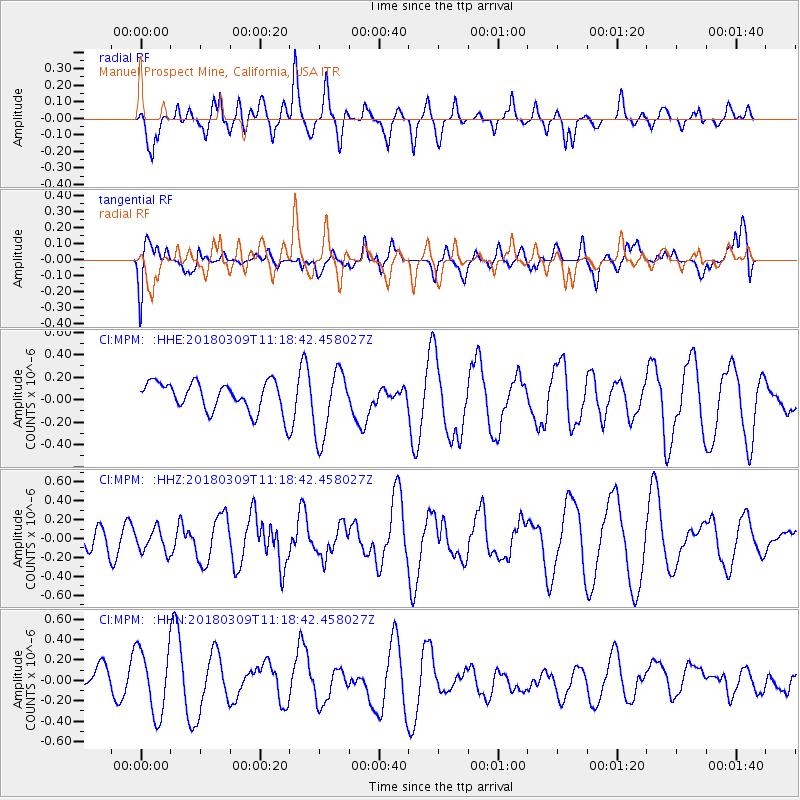
MPM Manuel Prospect Mine, California, USA - Earthquake Result Viewer
*The percent match for this event was below the threshold and hence no stack was calculated.
| Earthquake location: |
New Ireland Region, P.N.G. |
| Earthquake latitude/longitude: |
-4.3/153.3 |
| Earthquake time(UTC): |
2018/03/09 (068) 11:06:10 GMT |
| Earthquake Depth: |
46 km |
| Earthquake Magnitude: |
5.8 Mww |
| Earthquake Catalog/Contributor: |
NEIC PDE/us |
|
| Network: |
CI Caltech Regional Seismic Network |
| Station: |
MPM Manuel Prospect Mine, California, USA |
| Lat/Lon: |
36.06 N/117.49 W |
| Elevation: |
185 m |
|
| Distance: |
91.9 deg |
| Az: |
54.159 deg |
| Baz: |
266.016 deg |
| Ray Param: |
$rayparam |
*The percent match for this event was below the threshold and hence was not used in the summary stack. |
|
| Radial Match: |
42.172825 % |
| Radial Bump: |
400 |
| Transverse Match: |
36.10581 % |
| Transverse Bump: |
400 |
| SOD ConfigId: |
13570011 |
| Insert Time: |
2019-04-29 23:01:46.907 +0000 |
| GWidth: |
2.5 |
| Max Bumps: |
400 |
| Tol: |
0.001 |
|
Signal To Noise
| Channel | StoN | STA | LTA |
| CI:MPM: :HHZ:20180309T11:18:42.458027Z | 1.0698013 | 1.2483889E-7 | 1.1669353E-7 |
| CI:MPM: :HHN:20180309T11:18:42.458027Z | 2.0066018 | 3.2023718E-7 | 1.595918E-7 |
| CI:MPM: :HHE:20180309T11:18:42.458027Z | 2.344937 | 3.0461774E-7 | 1.2990444E-7 |
| Arrivals |
| Ps | |
| PpPs | |
| PsPs/PpSs | |


