You are here: Home > Network List > II - Global Seismograph Network (GSN - IRIS/IDA) Stations List
> Station WRAB Tennant Creek, NT, Australia > Earthquake Result Viewer
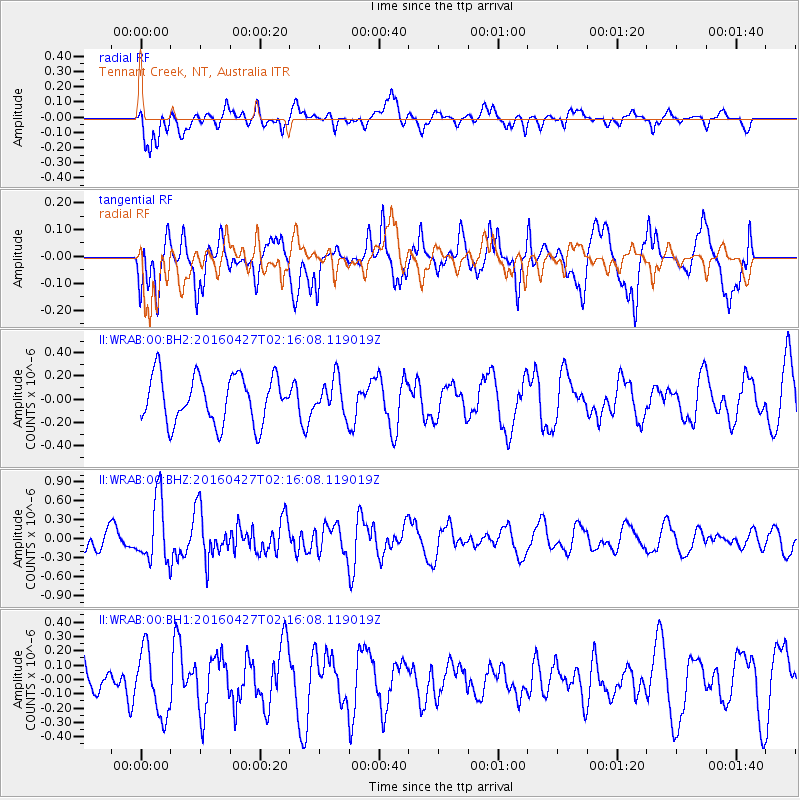
WRAB Tennant Creek, NT, Australia - Earthquake Result Viewer
*The percent match for this event was below the threshold and hence no stack was calculated.
| Earthquake location: |
South Of Africa |
| Earthquake latitude/longitude: |
-52.6/25.9 |
| Earthquake time(UTC): |
2016/04/27 (118) 02:04:04 GMT |
| Earthquake Depth: |
10 km |
| Earthquake Magnitude: |
5.6 MB |
| Earthquake Catalog/Contributor: |
NEIC PDE/NEIC ALERT |
|
| Network: |
II Global Seismograph Network (GSN - IRIS/IDA) |
| Station: |
WRAB Tennant Creek, NT, Australia |
| Lat/Lon: |
19.93 S/134.36 E |
| Elevation: |
366 m |
|
| Distance: |
85.0 deg |
| Az: |
116.406 deg |
| Baz: |
215.477 deg |
| Ray Param: |
$rayparam |
*The percent match for this event was below the threshold and hence was not used in the summary stack. |
|
| Radial Match: |
72.43056 % |
| Radial Bump: |
400 |
| Transverse Match: |
55.225765 % |
| Transverse Bump: |
400 |
| SOD ConfigId: |
1475611 |
| Insert Time: |
2016-05-11 02:06:38.075 +0000 |
| GWidth: |
2.5 |
| Max Bumps: |
400 |
| Tol: |
0.001 |
|
Signal To Noise
| Channel | StoN | STA | LTA |
| II:WRAB:00:BHZ:20160427T02:16:08.119019Z | 1.9523641 | 4.9835484E-7 | 2.552571E-7 |
| II:WRAB:00:BH1:20160427T02:16:08.119019Z | 1.7903022 | 2.2688104E-7 | 1.267278E-7 |
| II:WRAB:00:BH2:20160427T02:16:08.119019Z | 0.740418 | 1.502982E-7 | 2.0299102E-7 |
| Arrivals |
| Ps | |
| PpPs | |
| PsPs/PpSs | |


