You are here: Home > Network List > IW - Intermountain West Stations List
> Station MOOW Moose Ponds, Wyoming, USA > Earthquake Result Viewer
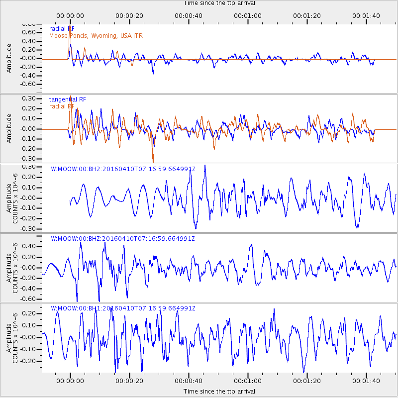
MOOW Moose Ponds, Wyoming, USA - Earthquake Result Viewer
*The percent match for this event was below the threshold and hence no stack was calculated.
| Earthquake location: |
Oaxaca, Mexico |
| Earthquake latitude/longitude: |
16.1/-96.3 |
| Earthquake time(UTC): |
2016/04/10 (101) 07:11:21 GMT |
| Earthquake Depth: |
25 km |
| Earthquake Magnitude: |
5.5 MWW, 5.2 MWB, 5.5 MWC |
| Earthquake Catalog/Contributor: |
NEIC PDE/NEIC COMCAT |
|
| Network: |
IW Intermountain West |
| Station: |
MOOW Moose Ponds, Wyoming, USA |
| Lat/Lon: |
43.75 N/110.74 W |
| Elevation: |
2128 m |
|
| Distance: |
30.2 deg |
| Az: |
338.892 deg |
| Baz: |
151.458 deg |
| Ray Param: |
$rayparam |
*The percent match for this event was below the threshold and hence was not used in the summary stack. |
|
| Radial Match: |
67.66167 % |
| Radial Bump: |
400 |
| Transverse Match: |
68.471535 % |
| Transverse Bump: |
400 |
| SOD ConfigId: |
1475611 |
| Insert Time: |
2016-05-11 10:58:25.298 +0000 |
| GWidth: |
2.5 |
| Max Bumps: |
400 |
| Tol: |
0.001 |
|
Signal To Noise
| Channel | StoN | STA | LTA |
| IW:MOOW:00:BHZ:20160410T07:16:59.664991Z | 3.2788591 | 2.634466E-7 | 8.034703E-8 |
| IW:MOOW:00:BH1:20160410T07:16:59.664991Z | 1.2289108 | 1.1098828E-7 | 9.0314344E-8 |
| IW:MOOW:00:BH2:20160410T07:16:59.664991Z | 1.0866517 | 8.445107E-8 | 7.771678E-8 |
| Arrivals |
| Ps | |
| PpPs | |
| PsPs/PpSs | |


