You are here: Home > Network List > TA - USArray Transportable Network (new EarthScope stations) Stations List
> Station I30M Mount Dempster, Yukon, CAN > Earthquake Result Viewer
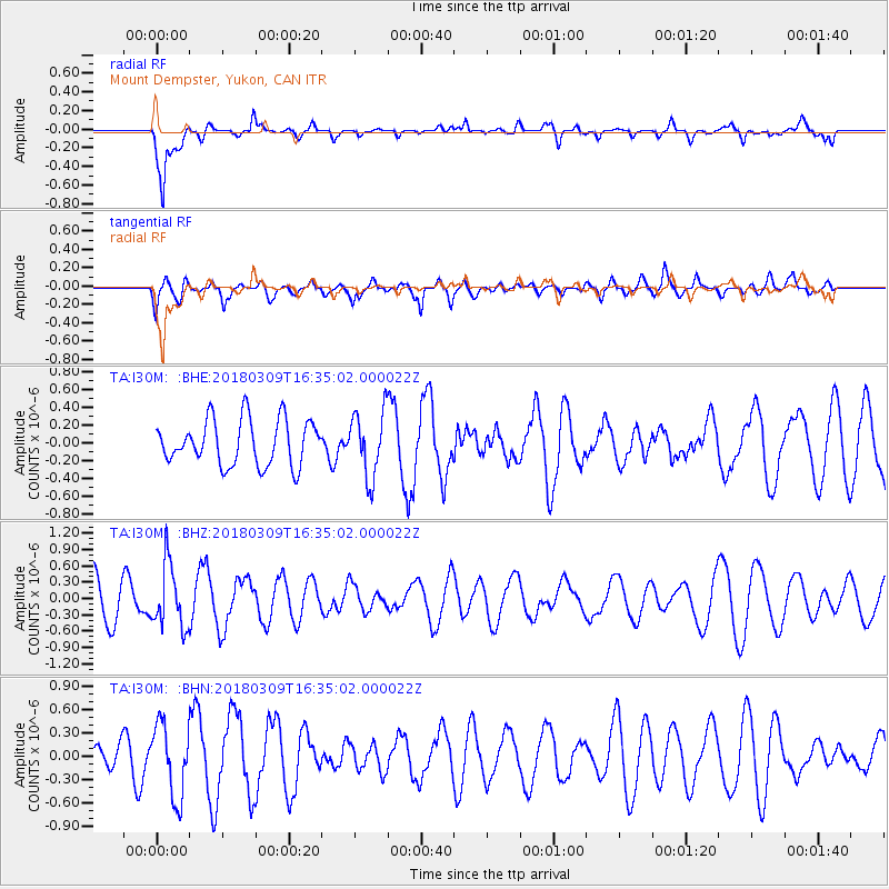
I30M Mount Dempster, Yukon, CAN - Earthquake Result Viewer
*The percent match for this event was below the threshold and hence no stack was calculated.
| Earthquake location: |
Fiji Islands Region |
| Earthquake latitude/longitude: |
-21.1/-178.5 |
| Earthquake time(UTC): |
2018/03/09 (068) 16:23:22 GMT |
| Earthquake Depth: |
539 km |
| Earthquake Magnitude: |
5.7 Mww |
| Earthquake Catalog/Contributor: |
NEIC PDE/us |
|
| Network: |
TA USArray Transportable Network (new EarthScope stations) |
| Station: |
I30M Mount Dempster, Yukon, CAN |
| Lat/Lon: |
65.22 N/136.38 W |
| Elevation: |
1399 m |
|
| Distance: |
91.9 deg |
| Az: |
16.443 deg |
| Baz: |
218.847 deg |
| Ray Param: |
$rayparam |
*The percent match for this event was below the threshold and hence was not used in the summary stack. |
|
| Radial Match: |
77.270386 % |
| Radial Bump: |
400 |
| Transverse Match: |
64.45359 % |
| Transverse Bump: |
400 |
| SOD ConfigId: |
13570011 |
| Insert Time: |
2019-04-29 23:11:23.320 +0000 |
| GWidth: |
2.5 |
| Max Bumps: |
400 |
| Tol: |
0.001 |
|
Signal To Noise
| Channel | StoN | STA | LTA |
| TA:I30M: :BHZ:20180309T16:35:02.000022Z | 1.7723262 | 5.7672275E-7 | 3.254044E-7 |
| TA:I30M: :BHN:20180309T16:35:02.000022Z | 2.5243425 | 4.6847737E-7 | 1.855839E-7 |
| TA:I30M: :BHE:20180309T16:35:02.000022Z | 1.4816 | 3.7515665E-7 | 2.532105E-7 |
| Arrivals |
| Ps | |
| PpPs | |
| PsPs/PpSs | |


