You are here: Home > Network List > BK - Berkeley Digital Seismograph Network Stations List
> Station HUMO Hull Mountain, OR > Earthquake Result Viewer
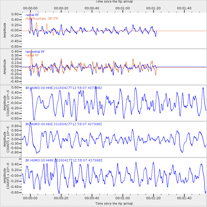
HUMO Hull Mountain, OR - Earthquake Result Viewer
*The percent match for this event was below the threshold and hence no stack was calculated.
| Earthquake location: |
Near Coast Of Chiapas, Mexico |
| Earthquake latitude/longitude: |
14.6/-93.0 |
| Earthquake time(UTC): |
2016/04/27 (118) 12:51:22 GMT |
| Earthquake Depth: |
35 km |
| Earthquake Magnitude: |
5.8 MB |
| Earthquake Catalog/Contributor: |
NEIC PDE/NEIC COMCAT |
|
| Network: |
BK Berkeley Digital Seismograph Network |
| Station: |
HUMO Hull Mountain, OR |
| Lat/Lon: |
42.61 N/122.96 W |
| Elevation: |
555 m |
|
| Distance: |
38.0 deg |
| Az: |
323.196 deg |
| Baz: |
128.216 deg |
| Ray Param: |
$rayparam |
*The percent match for this event was below the threshold and hence was not used in the summary stack. |
|
| Radial Match: |
60.87443 % |
| Radial Bump: |
400 |
| Transverse Match: |
61.738472 % |
| Transverse Bump: |
400 |
| SOD ConfigId: |
1475611 |
| Insert Time: |
2016-05-11 12:51:40.955 +0000 |
| GWidth: |
2.5 |
| Max Bumps: |
400 |
| Tol: |
0.001 |
|
Signal To Noise
| Channel | StoN | STA | LTA |
| BK:HUMO:00:HHZ:20160427T12:58:07.437998Z | 3.2252178 | 7.1421556E-7 | 2.2144724E-7 |
| BK:HUMO:00:HHN:20160427T12:58:07.437998Z | 1.1404303 | 2.0074535E-7 | 1.7602596E-7 |
| BK:HUMO:00:HHE:20160427T12:58:07.437998Z | 1.3980011 | 4.03931E-7 | 2.889347E-7 |
| Arrivals |
| Ps | |
| PpPs | |
| PsPs/PpSs | |


