You are here: Home > Network List > GT - Global Telemetered Seismograph Network (USAF/USGS) Stations List
> Station LPAZ La Paz , Bolivia > Earthquake Result Viewer
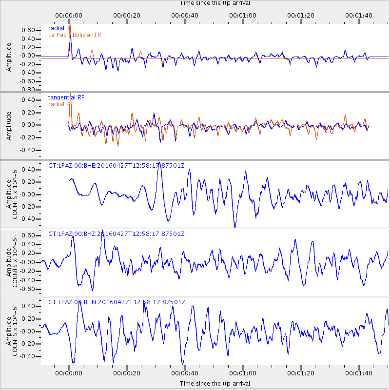
LPAZ La Paz , Bolivia - Earthquake Result Viewer
*The percent match for this event was below the threshold and hence no stack was calculated.
| Earthquake location: |
Near Coast Of Chiapas, Mexico |
| Earthquake latitude/longitude: |
14.6/-93.0 |
| Earthquake time(UTC): |
2016/04/27 (118) 12:51:22 GMT |
| Earthquake Depth: |
35 km |
| Earthquake Magnitude: |
5.8 MB |
| Earthquake Catalog/Contributor: |
NEIC PDE/NEIC COMCAT |
|
| Network: |
GT Global Telemetered Seismograph Network (USAF/USGS) |
| Station: |
LPAZ La Paz , Bolivia |
| Lat/Lon: |
16.17 S/68.08 W |
| Elevation: |
4817 m |
|
| Distance: |
39.2 deg |
| Az: |
140.233 deg |
| Baz: |
319.869 deg |
| Ray Param: |
$rayparam |
*The percent match for this event was below the threshold and hence was not used in the summary stack. |
|
| Radial Match: |
41.343124 % |
| Radial Bump: |
400 |
| Transverse Match: |
58.50213 % |
| Transverse Bump: |
393 |
| SOD ConfigId: |
1475611 |
| Insert Time: |
2016-05-11 12:52:27.646 +0000 |
| GWidth: |
2.5 |
| Max Bumps: |
400 |
| Tol: |
0.001 |
|
Signal To Noise
| Channel | StoN | STA | LTA |
| GT:LPAZ:00:BHZ:20160427T12:58:17.87501Z | 3.723413 | 3.7220025E-7 | 9.996212E-8 |
| GT:LPAZ:00:BHN:20160427T12:58:17.87501Z | 2.3702955 | 3.3287884E-7 | 1.404377E-7 |
| GT:LPAZ:00:BHE:20160427T12:58:17.87501Z | 3.2488601 | 3.1114263E-7 | 9.5769785E-8 |
| Arrivals |
| Ps | |
| PpPs | |
| PsPs/PpSs | |


