You are here: Home > Network List > TA - USArray Transportable Network (new EarthScope stations) Stations List
> Station I30M Mount Dempster, Yukon, CAN > Earthquake Result Viewer
I30M Mount Dempster, Yukon, CAN - Earthquake Result Viewer
*The percent match for this event was below the threshold and hence no stack was calculated.
| Earthquake location: |
Kuril Islands |
| Earthquake latitude/longitude: |
45.3/150.3 |
| Earthquake time(UTC): |
2018/03/18 (077) 18:00:10 GMT |
| Earthquake Depth: |
72 km |
| Earthquake Magnitude: |
5.1 Mww |
| Earthquake Catalog/Contributor: |
NEIC PDE/us |
|
| Network: |
TA USArray Transportable Network (new EarthScope stations) |
| Station: |
I30M Mount Dempster, Yukon, CAN |
| Lat/Lon: |
65.22 N/136.38 W |
| Elevation: |
1399 m |
|
| Distance: |
43.3 deg |
| Az: |
36.081 deg |
| Baz: |
279.675 deg |
| Ray Param: |
$rayparam |
*The percent match for this event was below the threshold and hence was not used in the summary stack. |
|
| Radial Match: |
47.00998 % |
| Radial Bump: |
400 |
| Transverse Match: |
39.183937 % |
| Transverse Bump: |
400 |
| SOD ConfigId: |
13570011 |
| Insert Time: |
2019-04-29 23:38:53.456 +0000 |
| GWidth: |
2.5 |
| Max Bumps: |
400 |
| Tol: |
0.001 |
|
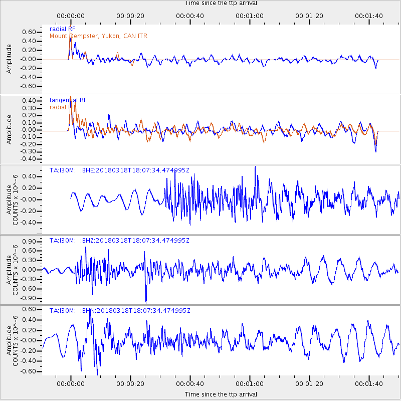
Signal To Noise
| Channel | StoN | STA | LTA |
| TA:I30M: :BHZ:20180318T18:07:34.474995Z | 2.8853106 | 2.1286849E-7 | 7.3776626E-8 |
| TA:I30M: :BHN:20180318T18:07:34.474995Z | 1.5927192 | 2.5831426E-7 | 1.6218442E-7 |
| TA:I30M: :BHE:20180318T18:07:34.474995Z | 1.4406434 | 1.4877996E-7 | 1.0327327E-7 |
| Arrivals |
| Ps | |
| PpPs | |
| PsPs/PpSs | |


