You are here: Home > Network List > TA - USArray Transportable Network (new EarthScope stations) Stations List
> Station J26L Joseph Creek, AK, USA > Earthquake Result Viewer
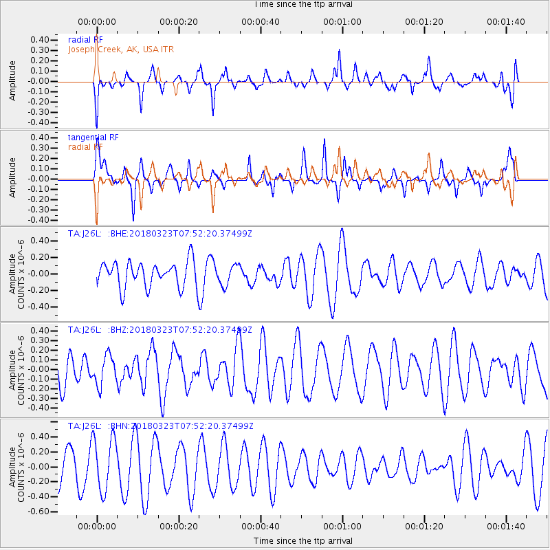
J26L Joseph Creek, AK, USA - Earthquake Result Viewer
*The percent match for this event was below the threshold and hence no stack was calculated.
| Earthquake location: |
Northern Mid-Atlantic Ridge |
| Earthquake latitude/longitude: |
12.7/-44.6 |
| Earthquake time(UTC): |
2018/03/23 (082) 07:40:29 GMT |
| Earthquake Depth: |
10 km |
| Earthquake Magnitude: |
5.5 Mwb |
| Earthquake Catalog/Contributor: |
NEIC PDE/us |
|
| Network: |
TA USArray Transportable Network (new EarthScope stations) |
| Station: |
J26L Joseph Creek, AK, USA |
| Lat/Lon: |
64.50 N/143.56 W |
| Elevation: |
1144 m |
|
| Distance: |
82.5 deg |
| Az: |
334.456 deg |
| Baz: |
76.482 deg |
| Ray Param: |
$rayparam |
*The percent match for this event was below the threshold and hence was not used in the summary stack. |
|
| Radial Match: |
48.321644 % |
| Radial Bump: |
340 |
| Transverse Match: |
42.504417 % |
| Transverse Bump: |
268 |
| SOD ConfigId: |
13570011 |
| Insert Time: |
2019-04-29 23:48:03.855 +0000 |
| GWidth: |
2.5 |
| Max Bumps: |
400 |
| Tol: |
0.001 |
|
Signal To Noise
| Channel | StoN | STA | LTA |
| TA:J26L: :BHZ:20180323T07:52:20.37499Z | 0.9914074 | 1.5566165E-7 | 1.5701079E-7 |
| TA:J26L: :BHN:20180323T07:52:20.37499Z | 2.3597906 | 3.5904208E-7 | 1.5214998E-7 |
| TA:J26L: :BHE:20180323T07:52:20.37499Z | 0.7894254 | 1.2127471E-7 | 1.5362403E-7 |
| Arrivals |
| Ps | |
| PpPs | |
| PsPs/PpSs | |


