You are here: Home > Network List > US - United States National Seismic Network Stations List
> Station TPNV Topopah Spring, Nevada, USA > Earthquake Result Viewer
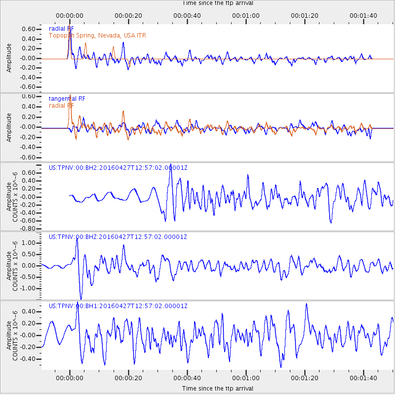
TPNV Topopah Spring, Nevada, USA - Earthquake Result Viewer
*The percent match for this event was below the threshold and hence no stack was calculated.
| Earthquake location: |
Near Coast Of Chiapas, Mexico |
| Earthquake latitude/longitude: |
14.6/-93.0 |
| Earthquake time(UTC): |
2016/04/27 (118) 12:51:22 GMT |
| Earthquake Depth: |
35 km |
| Earthquake Magnitude: |
5.8 MB |
| Earthquake Catalog/Contributor: |
NEIC PDE/NEIC COMCAT |
|
| Network: |
US United States National Seismic Network |
| Station: |
TPNV Topopah Spring, Nevada, USA |
| Lat/Lon: |
36.95 N/116.25 W |
| Elevation: |
1600 m |
|
| Distance: |
30.4 deg |
| Az: |
321.32 deg |
| Baz: |
130.944 deg |
| Ray Param: |
$rayparam |
*The percent match for this event was below the threshold and hence was not used in the summary stack. |
|
| Radial Match: |
77.96588 % |
| Radial Bump: |
400 |
| Transverse Match: |
70.022415 % |
| Transverse Bump: |
400 |
| SOD ConfigId: |
1475611 |
| Insert Time: |
2016-05-11 12:56:34.018 +0000 |
| GWidth: |
2.5 |
| Max Bumps: |
400 |
| Tol: |
0.001 |
|
Signal To Noise
| Channel | StoN | STA | LTA |
| US:TPNV:00:BHZ:20160427T12:57:02.00001Z | 9.768108 | 6.9293566E-7 | 7.093857E-8 |
| US:TPNV:00:BH1:20160427T12:57:02.00001Z | 2.0186462 | 2.8959647E-7 | 1.4346074E-7 |
| US:TPNV:00:BH2:20160427T12:57:02.00001Z | 4.5975666 | 3.9731137E-7 | 8.641775E-8 |
| Arrivals |
| Ps | |
| PpPs | |
| PsPs/PpSs | |


