You are here: Home > Network List > TA - USArray Transportable Network (new EarthScope stations) Stations List
> Station A16A West Butte Ranch, Sweetgrass, MT, USA > Earthquake Result Viewer
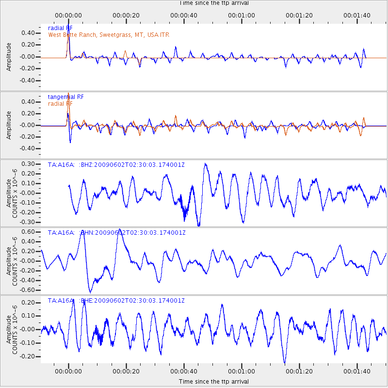
A16A West Butte Ranch, Sweetgrass, MT, USA - Earthquake Result Viewer
*The percent match for this event was below the threshold and hence no stack was calculated.
| Earthquake location: |
Vanuatu Islands |
| Earthquake latitude/longitude: |
-17.8/167.9 |
| Earthquake time(UTC): |
2009/06/02 (153) 02:17:03 GMT |
| Earthquake Depth: |
15 km |
| Earthquake Magnitude: |
5.7 MB, 6.2 MS, 6.3 MW, 6.3 MW |
| Earthquake Catalog/Contributor: |
WHDF/NEIC |
|
| Network: |
TA USArray Transportable Network (new EarthScope stations) |
| Station: |
A16A West Butte Ranch, Sweetgrass, MT, USA |
| Lat/Lon: |
48.95 N/111.60 W |
| Elevation: |
1394 m |
|
| Distance: |
97.1 deg |
| Az: |
40.931 deg |
| Baz: |
251.269 deg |
| Ray Param: |
$rayparam |
*The percent match for this event was below the threshold and hence was not used in the summary stack. |
|
| Radial Match: |
79.19364 % |
| Radial Bump: |
296 |
| Transverse Match: |
64.27291 % |
| Transverse Bump: |
400 |
| SOD ConfigId: |
2648 |
| Insert Time: |
2010-03-06 09:52:45.805 +0000 |
| GWidth: |
2.5 |
| Max Bumps: |
400 |
| Tol: |
0.001 |
|
Signal To Noise
| Channel | StoN | STA | LTA |
| TA:A16A: :BHN:20090602T02:30:03.174001Z | 2.5465536 | 2.9056955E-7 | 1.1410306E-7 |
| TA:A16A: :BHE:20090602T02:30:03.174001Z | 1.9463955 | 1.2390534E-7 | 6.365887E-8 |
| TA:A16A: :BHZ:20090602T02:30:03.174001Z | 1.2748164 | 1.1477144E-7 | 9.002978E-8 |
| Arrivals |
| Ps | |
| PpPs | |
| PsPs/PpSs | |


