You are here: Home > Network List > TA - USArray Transportable Network (new EarthScope stations) Stations List
> Station A16A West Butte Ranch, Sweetgrass, MT, USA > Earthquake Result Viewer
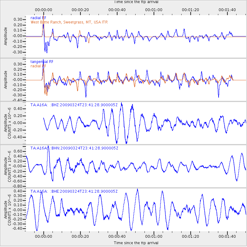
A16A West Butte Ranch, Sweetgrass, MT, USA - Earthquake Result Viewer
*The percent match for this event was below the threshold and hence no stack was calculated.
| Earthquake location: |
New Britain Region, P.N.G. |
| Earthquake latitude/longitude: |
-5.1/151.8 |
| Earthquake time(UTC): |
2009/03/24 (083) 23:28:27 GMT |
| Earthquake Depth: |
36 km |
| Earthquake Magnitude: |
5.6 MB, 5.4 MS, 5.8 MW, 5.8 MW |
| Earthquake Catalog/Contributor: |
WHDF/NEIC |
|
| Network: |
TA USArray Transportable Network (new EarthScope stations) |
| Station: |
A16A West Butte Ranch, Sweetgrass, MT, USA |
| Lat/Lon: |
48.95 N/111.60 W |
| Elevation: |
1394 m |
|
| Distance: |
98.2 deg |
| Az: |
41.424 deg |
| Baz: |
271.557 deg |
| Ray Param: |
$rayparam |
*The percent match for this event was below the threshold and hence was not used in the summary stack. |
|
| Radial Match: |
57.199585 % |
| Radial Bump: |
363 |
| Transverse Match: |
59.952194 % |
| Transverse Bump: |
400 |
| SOD ConfigId: |
2658 |
| Insert Time: |
2010-03-06 09:53:10.552 +0000 |
| GWidth: |
2.5 |
| Max Bumps: |
400 |
| Tol: |
0.001 |
|
Signal To Noise
| Channel | StoN | STA | LTA |
| TA:A16A: :BHN:20090324T23:41:28.900005Z | 1.7402111 | 3.858867E-7 | 2.2174704E-7 |
| TA:A16A: :BHE:20090324T23:41:28.900005Z | 1.0014087 | 1.8983015E-7 | 1.8956311E-7 |
| TA:A16A: :BHZ:20090324T23:41:28.900005Z | 1.495994 | 1.8614013E-7 | 1.2442572E-7 |
| Arrivals |
| Ps | |
| PpPs | |
| PsPs/PpSs | |


