You are here: Home > Network List > WY - Yellowstone Wyoming Seismic Network Stations List
> Station YHR Hawk's Rest, WY, USA > Earthquake Result Viewer
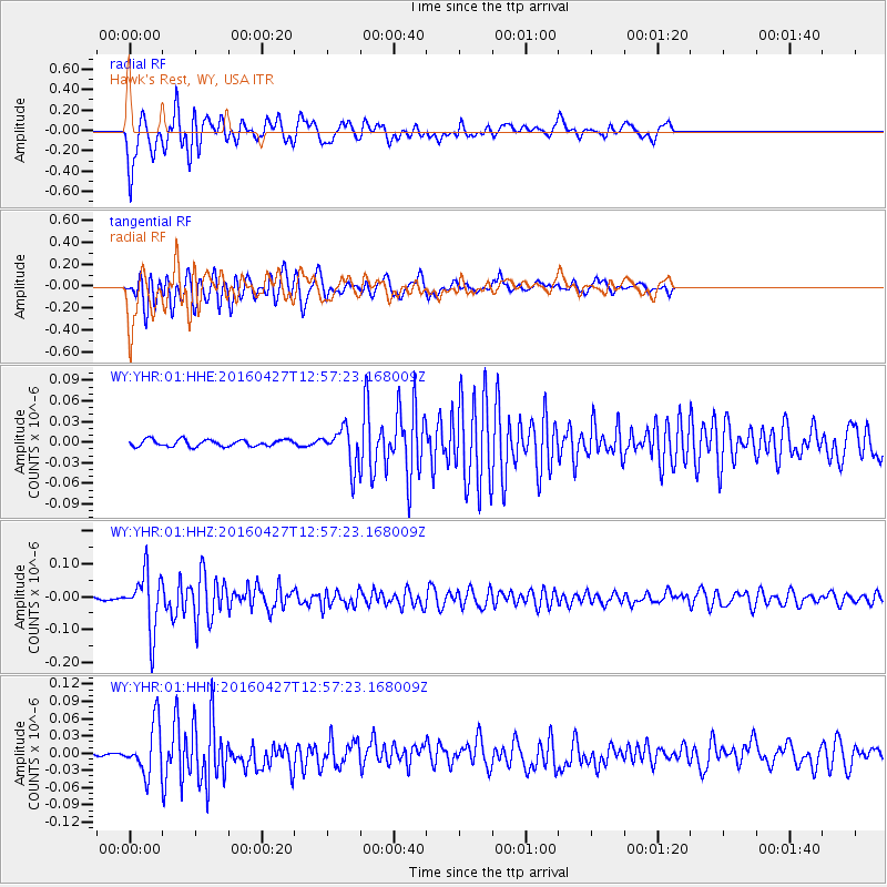
YHR Hawk's Rest, WY, USA - Earthquake Result Viewer
*The percent match for this event was below the threshold and hence no stack was calculated.
| Earthquake location: |
Near Coast Of Chiapas, Mexico |
| Earthquake latitude/longitude: |
14.6/-93.0 |
| Earthquake time(UTC): |
2016/04/27 (118) 12:51:22 GMT |
| Earthquake Depth: |
35 km |
| Earthquake Magnitude: |
5.8 MB |
| Earthquake Catalog/Contributor: |
NEIC PDE/NEIC COMCAT |
|
| Network: |
WY Yellowstone Wyoming Seismic Network |
| Station: |
YHR Hawk's Rest, WY, USA |
| Lat/Lon: |
44.11 N/110.08 W |
| Elevation: |
2976 m |
|
| Distance: |
32.9 deg |
| Az: |
336.999 deg |
| Baz: |
148.319 deg |
| Ray Param: |
$rayparam |
*The percent match for this event was below the threshold and hence was not used in the summary stack. |
|
| Radial Match: |
84.63849 % |
| Radial Bump: |
400 |
| Transverse Match: |
80.032585 % |
| Transverse Bump: |
400 |
| SOD ConfigId: |
1475611 |
| Insert Time: |
2016-05-11 12:57:39.791 +0000 |
| GWidth: |
2.5 |
| Max Bumps: |
400 |
| Tol: |
0.001 |
|
Signal To Noise
| Channel | StoN | STA | LTA |
| WY:YHR:01:HHZ:20160427T12:57:23.168009Z | 19.470617 | 8.6775735E-8 | 4.456753E-9 |
| WY:YHR:01:HHN:20160427T12:57:23.168009Z | 10.473467 | 4.2941863E-8 | 4.100062E-9 |
| WY:YHR:01:HHE:20160427T12:57:23.168009Z | 5.8059287 | 2.7657551E-8 | 4.763674E-9 |
| Arrivals |
| Ps | |
| PpPs | |
| PsPs/PpSs | |


