JCS Julian Camp Stevens, California, USA - Earthquake Result Viewer
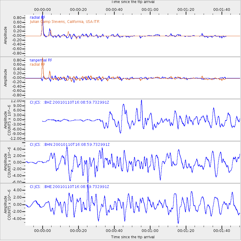
Earthquake location: Kodiak Island Region, Alaska
Earthquake latitude/longitude: 57.1/-153.2
Earthquake time(UTC): 2001/01/10 (010) 16:02:44 GMT
Earthquake Depth: 33 km
Earthquake Magnitude: 6.2 MB, 6.8 MS, 7.1 MW, 6.8 ML
Earthquake Catalog/Contributor: WHDF/NEIC
Network: CI Caltech Regional Seismic Network
Station: JCS Julian Camp Stevens, California, USA
Lat/Lon: 33.09 N/116.60 W
Elevation: 1258 m
Distance: 34.6 deg
Az: 118.141 deg
Baz: 325.001 deg
Ray Param: 0.07759856
Estimated Moho Depth: 28.75 km
Estimated Crust Vp/Vs: 1.85
Assumed Crust Vp: 6.264 km/s
Estimated Crust Vs: 3.395 km/s
Estimated Crust Poisson's Ratio: 0.29
Radial Match: 90.91471 %
Radial Bump: 342
Transverse Match: 73.73691 %
Transverse Bump: 400
SOD ConfigId: 3787
Insert Time: 2010-02-26 01:52:16.814 +0000
GWidth: 2.5
Max Bumps: 400
Tol: 0.001

Signal To Noise

ChannelStoNSTALTA
CI:JCS: :BHN:20010110T16:08:59.732991Z2.72615481.438576E-65.276941E-7
CI:JCS: :BHE:20010110T16:08:59.732991Z1.29149857.9184133E-76.1311823E-7
CI:JCS: :BHZ:20010110T16:08:59.732991Z4.9804651.8446548E-63.7037802E-7
Arrivals
Ps4.2 SECOND
PpPs12 SECOND
PsPs/PpSs16 SECOND