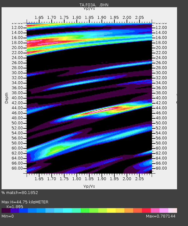
F03A Seaside, OR, USA - Earthquake Result Viewer
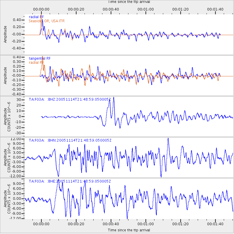
Earthquake location: Off East Coast Of Honshu, Japan
Earthquake latitude/longitude: 38.1/144.9
Earthquake time(UTC): 2005/11/14 (318) 21:38:51 GMT
Earthquake Depth: 11 km
Earthquake Magnitude: 6.7 MB, 6.8 MS, 7.0 MW, 6.9 MW
Earthquake Catalog/Contributor: WHDF/NEIC
Network: TA USArray Transportable Network (new EarthScope stations)
Station: F03A Seaside, OR, USA
Lat/Lon: 45.93 N/123.56 W
Elevation: 325 m
Distance: 64.8 deg
Az: 50.432 deg
Baz: 299.39 deg
Ray Param: 0.058667976
Estimated Moho Depth: 44.75 km
Estimated Crust Vp/Vs: 1.89
Assumed Crust Vp: 6.566 km/s
Estimated Crust Vs: 3.465 km/s
Estimated Crust Poisson's Ratio: 0.31
Radial Match: 80.1852 %
Radial Bump: 400
Transverse Match: 75.70165 %
Transverse Bump: 400
SOD ConfigId: 2448
Insert Time: 2010-03-06 09:54:19.087 +0000
GWidth: 2.5
Max Bumps: 400
Tol: 0.001

Signal To Noise

ChannelStoNSTALTA
TA:F03A: :BHN:20051114T21:48:59.050005Z0.943675649.090153E-79.632708E-7
TA:F03A: :BHE:20051114T21:48:59.050005Z0.647713369.098429E-71.4046999E-6
TA:F03A: :BHZ:20051114T21:48:59.050005Z2.53736541.9888857E-67.8383886E-7
Arrivals
Ps6.4 SECOND
PpPs19 SECOND
PsPs/PpSs25 SECOND