
F03A Seaside, OR, USA - Earthquake Result Viewer
| ||||||||||||||||||
| ||||||||||||||||||
| ||||||||||||||||||
|
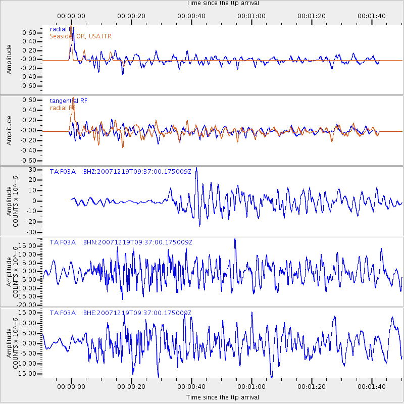
Signal To Noise
| Channel | StoN | STA | LTA |
| TA:F03A: :BHN:20071219T09:37:00.175009Z | 1.368875 | 3.83316E-6 | 2.8002266E-6 |
| TA:F03A: :BHE:20071219T09:37:00.175009Z | 1.2457334 | 2.5364836E-6 | 2.0361367E-6 |
| TA:F03A: :BHZ:20071219T09:37:00.175009Z | 2.589812 | 4.5808993E-6 | 1.7688153E-6 |
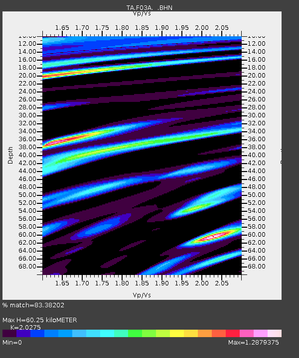
| Arrivals | |
| Ps | 10 SECOND |
| PpPs | 26 SECOND |
| PsPs/PpSs | 36 SECOND |

