F03A Seaside, OR, USA - Earthquake Result Viewer
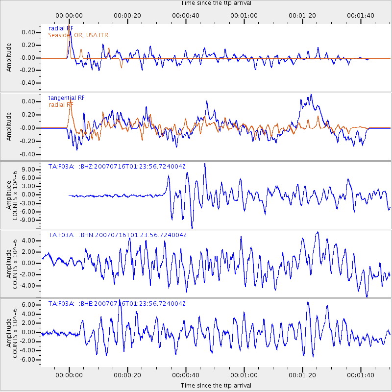
Earthquake location: Near West Coast Of Honshu, Japan
Earthquake latitude/longitude: 37.5/138.4
Earthquake time(UTC): 2007/07/16 (197) 01:13:22 GMT
Earthquake Depth: 12 km
Earthquake Magnitude: 6.5 MB, 6.4 MS, 6.6 MW, 6.5 MW
Earthquake Catalog/Contributor: WHDF/NEIC
Network: TA USArray Transportable Network (new EarthScope stations)
Station: F03A Seaside, OR, USA
Lat/Lon: 45.93 N/123.56 W
Elevation: 325 m
Distance: 69.1 deg
Az: 47.732 deg
Baz: 302.556 deg
Ray Param: 0.05588944
Estimated Moho Depth: 59.25 km
Estimated Crust Vp/Vs: 1.72
Assumed Crust Vp: 6.566 km/s
Estimated Crust Vs: 3.823 km/s
Estimated Crust Poisson's Ratio: 0.24
Radial Match: 83.28964 %
Radial Bump: 400
Transverse Match: 63.38167 %
Transverse Bump: 400
SOD ConfigId: 2564
Insert Time: 2010-03-06 09:54:51.614 +0000
GWidth: 2.5
Max Bumps: 400
Tol: 0.001

Signal To Noise

ChannelStoNSTALTA
TA:F03A: :BHN:20070716T01:23:56.724004Z0.546101331.0746186E-61.9678007E-6
TA:F03A: :BHE:20070716T01:23:56.724004Z2.86080861.0368346E-63.624271E-7
TA:F03A: :BHZ:20070716T01:23:56.724004Z11.6140622.4539097E-62.112878E-7
Arrivals
Ps6.7 SECOND
PpPs24 SECOND
PsPs/PpSs30 SECOND