F03A Seaside, OR, USA - Earthquake Result Viewer
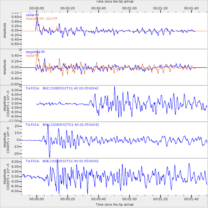
Earthquake location: Andreanof Islands, Aleutian Is.
Earthquake latitude/longitude: 51.9/-177.5
Earthquake time(UTC): 2008/05/02 (123) 01:33:37 GMT
Earthquake Depth: 14 km
Earthquake Magnitude: 6.3 MB, 6.8 MS, 6.6 MW, 6.6 MW
Earthquake Catalog/Contributor: WHDF/NEIC
Network: TA USArray Transportable Network (new EarthScope stations)
Station: F03A Seaside, OR, USA
Lat/Lon: 45.93 N/123.56 W
Elevation: 325 m
Distance: 35.3 deg
Az: 77.803 deg
Baz: 299.725 deg
Ray Param: 0.077301204
Estimated Moho Depth: 35.75 km
Estimated Crust Vp/Vs: 1.92
Assumed Crust Vp: 6.566 km/s
Estimated Crust Vs: 3.415 km/s
Estimated Crust Poisson's Ratio: 0.31
Radial Match: 85.81608 %
Radial Bump: 400
Transverse Match: 75.56243 %
Transverse Bump: 400
SOD ConfigId: 2504
Insert Time: 2010-03-06 09:55:22.662 +0000
GWidth: 2.5
Max Bumps: 400
Tol: 0.001

Signal To Noise

ChannelStoNSTALTA
TA:F03A: :BHN:20080502T01:40:00.650004Z7.42834762.1261294E-62.8621832E-7
TA:F03A: :BHE:20080502T01:40:00.650004Z1.20316898.8405693E-77.347738E-7
TA:F03A: :BHZ:20080502T01:40:00.650004Z1.85377627.507907E-74.0500615E-7
Arrivals
Ps5.4 SECOND
PpPs15 SECOND
PsPs/PpSs20 SECOND