You are here: Home > Network List > TA - USArray Transportable Network (new EarthScope stations) Stations List
> Station F03A Seaside, OR, USA > Earthquake Result Viewer
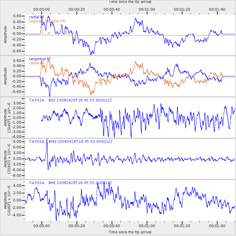
F03A Seaside, OR, USA - Earthquake Result Viewer
*The percent match for this event was below the threshold and hence no stack was calculated.
| Earthquake location: |
Vanuatu Islands |
| Earthquake latitude/longitude: |
-19.9/169.0 |
| Earthquake time(UTC): |
2008/04/28 (119) 18:33:34 GMT |
| Earthquake Depth: |
32 km |
| Earthquake Magnitude: |
6.2 MB, 6.2 MS, 6.4 MW, 6.4 MW |
| Earthquake Catalog/Contributor: |
WHDF/NEIC |
|
| Network: |
TA USArray Transportable Network (new EarthScope stations) |
| Station: |
F03A Seaside, OR, USA |
| Lat/Lon: |
45.93 N/123.56 W |
| Elevation: |
325 m |
|
| Distance: |
89.5 deg |
| Az: |
40.149 deg |
| Baz: |
240.356 deg |
| Ray Param: |
$rayparam |
*The percent match for this event was below the threshold and hence was not used in the summary stack. |
|
| Radial Match: |
55.002975 % |
| Radial Bump: |
400 |
| Transverse Match: |
58.99387 % |
| Transverse Bump: |
400 |
| SOD ConfigId: |
2504 |
| Insert Time: |
2010-03-06 09:55:29.575 +0000 |
| GWidth: |
2.5 |
| Max Bumps: |
400 |
| Tol: |
0.001 |
|
Signal To Noise
| Channel | StoN | STA | LTA |
| TA:F03A: :BHN:20080428T18:45:56.900012Z | 6.888106 | 3.4587304E-6 | 5.0213083E-7 |
| TA:F03A: :BHE:20080428T18:45:56.900012Z | 0.77282727 | 1.0471965E-6 | 1.3550201E-6 |
| TA:F03A: :BHZ:20080428T18:45:56.900012Z | 0.7263834 | 5.4947475E-7 | 7.564528E-7 |
| Arrivals |
| Ps | |
| PpPs | |
| PsPs/PpSs | |


