You are here: Home > Network List > TA - USArray Transportable Network (new EarthScope stations) Stations List
> Station F03A Seaside, OR, USA > Earthquake Result Viewer
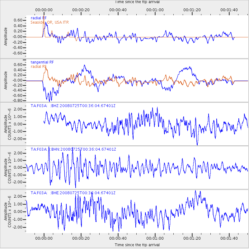
F03A Seaside, OR, USA - Earthquake Result Viewer
*The percent match for this event was below the threshold and hence no stack was calculated.
| Earthquake location: |
Rat Islands, Aleutian Islands |
| Earthquake latitude/longitude: |
51.3/179.0 |
| Earthquake time(UTC): |
2008/07/25 (207) 00:29:22 GMT |
| Earthquake Depth: |
21 km |
| Earthquake Magnitude: |
5.7 MB, 5.5 MS, 5.9 MW, 5.9 MW |
| Earthquake Catalog/Contributor: |
WHDF/NEIC |
|
| Network: |
TA USArray Transportable Network (new EarthScope stations) |
| Station: |
F03A Seaside, OR, USA |
| Lat/Lon: |
45.93 N/123.56 W |
| Elevation: |
325 m |
|
| Distance: |
37.5 deg |
| Az: |
74.998 deg |
| Baz: |
299.629 deg |
| Ray Param: |
$rayparam |
*The percent match for this event was below the threshold and hence was not used in the summary stack. |
|
| Radial Match: |
48.137047 % |
| Radial Bump: |
400 |
| Transverse Match: |
34.833405 % |
| Transverse Bump: |
400 |
| SOD ConfigId: |
2504 |
| Insert Time: |
2010-03-06 09:55:50.519 +0000 |
| GWidth: |
2.5 |
| Max Bumps: |
400 |
| Tol: |
0.001 |
|
Signal To Noise
| Channel | StoN | STA | LTA |
| TA:F03A: :BHN:20080725T00:36:04.67401Z | 3.1982985 | 1.2650537E-6 | 3.955396E-7 |
| TA:F03A: :BHE:20080725T00:36:04.67401Z | 0.8222628 | 5.867274E-7 | 7.1355214E-7 |
| TA:F03A: :BHZ:20080725T00:36:04.67401Z | 1.2244484 | 8.0300987E-7 | 6.5581355E-7 |
| Arrivals |
| Ps | |
| PpPs | |
| PsPs/PpSs | |


