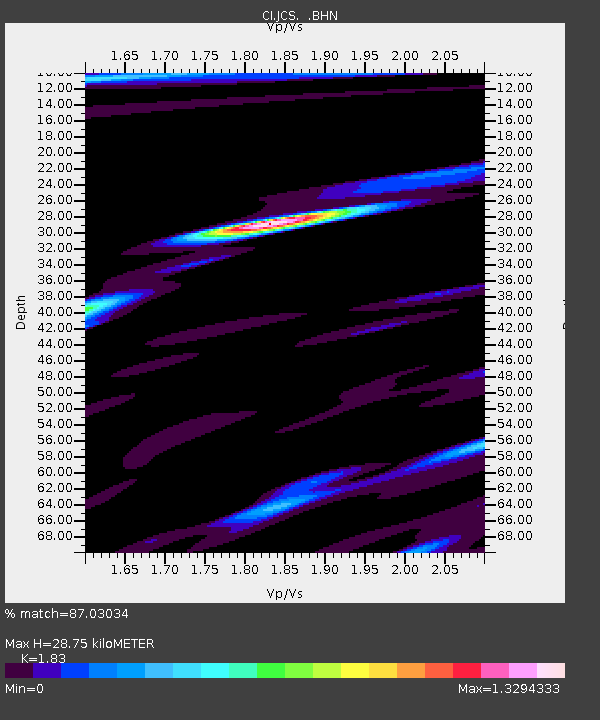
JCS Julian Camp Stevens, California, USA - Earthquake Result Viewer
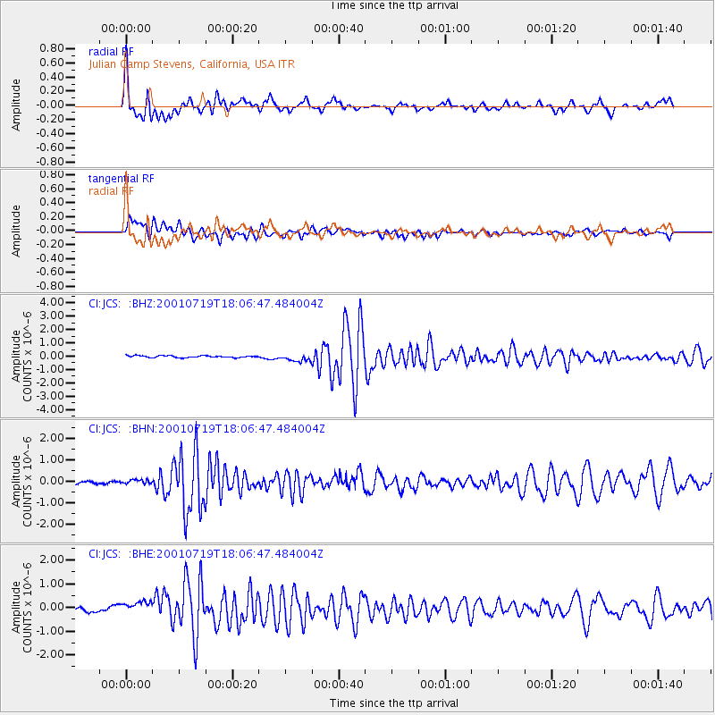
Earthquake location: Kodiak Island Region, Alaska
Earthquake latitude/longitude: 57.2/-151.0
Earthquake time(UTC): 2001/07/19 (200) 18:00:40 GMT
Earthquake Depth: 33 km
Earthquake Magnitude: 5.9 MB, 5.4 MS, 5.9 MW, 5.9 ML
Earthquake Catalog/Contributor: WHDF/NEIC
Network: CI Caltech Regional Seismic Network
Station: JCS Julian Camp Stevens, California, USA
Lat/Lon: 33.09 N/116.60 W
Elevation: 1258 m
Distance: 33.6 deg
Az: 120.989 deg
Baz: 326.238 deg
Ray Param: 0.07806563
Estimated Moho Depth: 28.75 km
Estimated Crust Vp/Vs: 1.83
Assumed Crust Vp: 6.264 km/s
Estimated Crust Vs: 3.423 km/s
Estimated Crust Poisson's Ratio: 0.29
Radial Match: 87.03034 %
Radial Bump: 400
Transverse Match: 81.566956 %
Transverse Bump: 400
SOD ConfigId: 3770
Insert Time: 2010-02-26 01:52:29.534 +0000
GWidth: 2.5
Max Bumps: 400
Tol: 0.001

Signal To Noise

ChannelStoNSTALTA
CI:JCS: :BHN:20010719T18:06:47.484004Z1.45441111.04729715E-77.2008326E-8
CI:JCS: :BHE:20010719T18:06:47.484004Z4.51207353.5669962E-77.905448E-8
CI:JCS: :BHZ:20010719T18:06:47.484004Z3.96746472.847626E-77.177445E-8
Arrivals
Ps4.1 SECOND
PpPs12 SECOND
PsPs/PpSs16 SECOND