You are here: Home > Network List > TA - USArray Transportable Network (new EarthScope stations) Stations List
> Station F03A Seaside, OR, USA > Earthquake Result Viewer
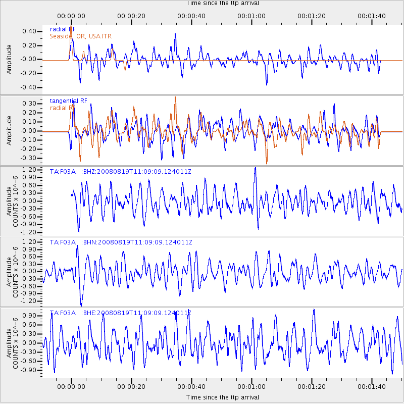
F03A Seaside, OR, USA - Earthquake Result Viewer
*The percent match for this event was below the threshold and hence no stack was calculated.
| Earthquake location: |
Easter Island Region |
| Earthquake latitude/longitude: |
-28.5/-112.8 |
| Earthquake time(UTC): |
2008/08/19 (232) 10:58:00 GMT |
| Earthquake Depth: |
9.0 km |
| Earthquake Magnitude: |
5.5 MB, 5.3 MS, 5.7 MW, 5.7 MW |
| Earthquake Catalog/Contributor: |
WHDF/NEIC |
|
| Network: |
TA USArray Transportable Network (new EarthScope stations) |
| Station: |
F03A Seaside, OR, USA |
| Lat/Lon: |
45.93 N/123.56 W |
| Elevation: |
325 m |
|
| Distance: |
74.8 deg |
| Az: |
352.269 deg |
| Baz: |
170.237 deg |
| Ray Param: |
$rayparam |
*The percent match for this event was below the threshold and hence was not used in the summary stack. |
|
| Radial Match: |
54.444447 % |
| Radial Bump: |
400 |
| Transverse Match: |
50.94233 % |
| Transverse Bump: |
400 |
| SOD ConfigId: |
2504 |
| Insert Time: |
2010-03-06 09:56:34.656 +0000 |
| GWidth: |
2.5 |
| Max Bumps: |
400 |
| Tol: |
0.001 |
|
Signal To Noise
| Channel | StoN | STA | LTA |
| TA:F03A: :BHN:20080819T11:09:09.124011Z | 3.354474 | 6.399425E-7 | 1.9077284E-7 |
| TA:F03A: :BHE:20080819T11:09:09.124011Z | 0.75139594 | 3.2062073E-7 | 4.2670013E-7 |
| TA:F03A: :BHZ:20080819T11:09:09.124011Z | 0.6530431 | 2.8513122E-7 | 4.366193E-7 |
| Arrivals |
| Ps | |
| PpPs | |
| PsPs/PpSs | |


