You are here: Home > Network List > TA - USArray Transportable Network (new EarthScope stations) Stations List
> Station F03A Seaside, OR, USA > Earthquake Result Viewer
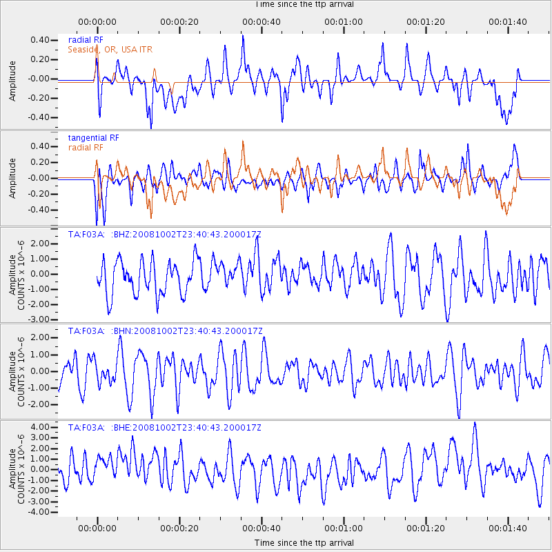
F03A Seaside, OR, USA - Earthquake Result Viewer
*The percent match for this event was below the threshold and hence no stack was calculated.
| Earthquake location: |
Southeast Of Loyalty Islands |
| Earthquake latitude/longitude: |
-23.0/169.9 |
| Earthquake time(UTC): |
2008/10/02 (276) 23:28:09 GMT |
| Earthquake Depth: |
10 km |
| Earthquake Magnitude: |
5.8 MB, 5.5 MS, 5.8 MW, 5.8 MW |
| Earthquake Catalog/Contributor: |
WHDF/NEIC |
|
| Network: |
TA USArray Transportable Network (new EarthScope stations) |
| Station: |
F03A Seaside, OR, USA |
| Lat/Lon: |
45.93 N/123.56 W |
| Elevation: |
325 m |
|
| Distance: |
91.3 deg |
| Az: |
39.837 deg |
| Baz: |
237.74 deg |
| Ray Param: |
$rayparam |
*The percent match for this event was below the threshold and hence was not used in the summary stack. |
|
| Radial Match: |
54.4335 % |
| Radial Bump: |
400 |
| Transverse Match: |
68.272514 % |
| Transverse Bump: |
400 |
| SOD ConfigId: |
2560 |
| Insert Time: |
2010-03-06 09:56:44.155 +0000 |
| GWidth: |
2.5 |
| Max Bumps: |
400 |
| Tol: |
0.001 |
|
Signal To Noise
| Channel | StoN | STA | LTA |
| TA:F03A: :BHN:20081002T23:40:43.200017Z | 0.8835876 | 5.900371E-7 | 6.6777426E-7 |
| TA:F03A: :BHE:20081002T23:40:43.200017Z | 1.2000384 | 1.3789132E-6 | 1.1490577E-6 |
| TA:F03A: :BHZ:20081002T23:40:43.200017Z | 0.68021905 | 7.439642E-7 | 1.0937126E-6 |
| Arrivals |
| Ps | |
| PpPs | |
| PsPs/PpSs | |


