You are here: Home > Network List > TA - USArray Transportable Network (new EarthScope stations) Stations List
> Station J26L Joseph Creek, AK, USA > Earthquake Result Viewer
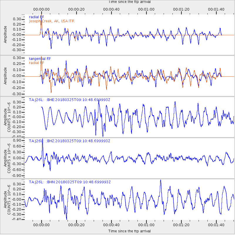
J26L Joseph Creek, AK, USA - Earthquake Result Viewer
*The percent match for this event was below the threshold and hence no stack was calculated.
| Earthquake location: |
Banda Sea |
| Earthquake latitude/longitude: |
-7.3/128.5 |
| Earthquake time(UTC): |
2018/03/25 (084) 08:58:11 GMT |
| Earthquake Depth: |
149 km |
| Earthquake Magnitude: |
5.6 Mww |
| Earthquake Catalog/Contributor: |
NEIC PDE/us |
|
| Network: |
TA USArray Transportable Network (new EarthScope stations) |
| Station: |
J26L Joseph Creek, AK, USA |
| Lat/Lon: |
64.50 N/143.56 W |
| Elevation: |
1144 m |
|
| Distance: |
95.6 deg |
| Az: |
25.765 deg |
| Baz: |
264.987 deg |
| Ray Param: |
$rayparam |
*The percent match for this event was below the threshold and hence was not used in the summary stack. |
|
| Radial Match: |
56.015865 % |
| Radial Bump: |
354 |
| Transverse Match: |
65.70075 % |
| Transverse Bump: |
398 |
| SOD ConfigId: |
13570011 |
| Insert Time: |
2019-04-30 00:08:43.125 +0000 |
| GWidth: |
2.5 |
| Max Bumps: |
400 |
| Tol: |
0.001 |
|
Signal To Noise
| Channel | StoN | STA | LTA |
| TA:J26L: :BHZ:20180325T09:10:48.699993Z | 3.9776309 | 3.1340983E-7 | 7.8793086E-8 |
| TA:J26L: :BHN:20180325T09:10:48.699993Z | 0.932468 | 1.0566621E-7 | 1.1331886E-7 |
| TA:J26L: :BHE:20180325T09:10:48.699993Z | 1.3637385 | 1.5637906E-7 | 1.1466938E-7 |
| Arrivals |
| Ps | |
| PpPs | |
| PsPs/PpSs | |


