You are here: Home > Network List > TA - USArray Transportable Network (new EarthScope stations) Stations List
> Station F03A Seaside, OR, USA > Earthquake Result Viewer
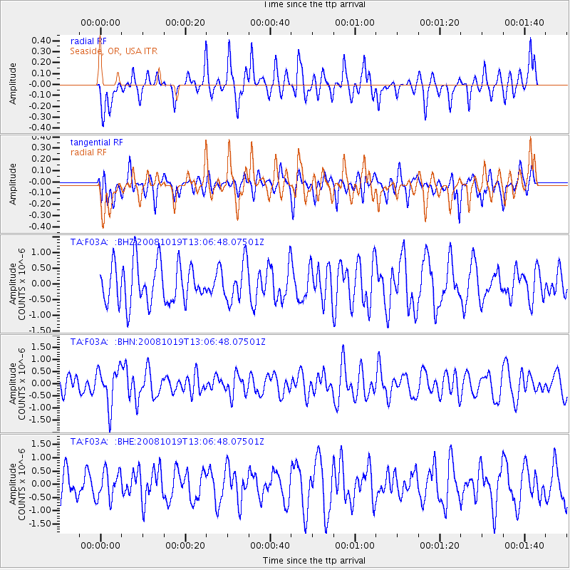
F03A Seaside, OR, USA - Earthquake Result Viewer
*The percent match for this event was below the threshold and hence no stack was calculated.
| Earthquake location: |
Tonga Islands |
| Earthquake latitude/longitude: |
-22.0/-173.7 |
| Earthquake time(UTC): |
2008/10/19 (293) 12:55:05 GMT |
| Earthquake Depth: |
35 km |
| Earthquake Magnitude: |
5.7 MB, 5.3 MS, 5.6 MW, 5.5 MW |
| Earthquake Catalog/Contributor: |
WHDF/NEIC |
|
| Network: |
TA USArray Transportable Network (new EarthScope stations) |
| Station: |
F03A Seaside, OR, USA |
| Lat/Lon: |
45.93 N/123.56 W |
| Elevation: |
325 m |
|
| Distance: |
81.4 deg |
| Az: |
32.805 deg |
| Baz: |
226.1 deg |
| Ray Param: |
$rayparam |
*The percent match for this event was below the threshold and hence was not used in the summary stack. |
|
| Radial Match: |
60.53905 % |
| Radial Bump: |
361 |
| Transverse Match: |
41.1585 % |
| Transverse Bump: |
400 |
| SOD ConfigId: |
2560 |
| Insert Time: |
2010-03-06 09:56:48.505 +0000 |
| GWidth: |
2.5 |
| Max Bumps: |
400 |
| Tol: |
0.001 |
|
Signal To Noise
| Channel | StoN | STA | LTA |
| TA:F03A: :BHN:20081019T13:06:48.07501Z | 2.14712 | 7.883096E-7 | 3.6714744E-7 |
| TA:F03A: :BHE:20081019T13:06:48.07501Z | 0.8695962 | 5.288423E-7 | 6.0814693E-7 |
| TA:F03A: :BHZ:20081019T13:06:48.07501Z | 0.9782143 | 6.1816485E-7 | 6.319319E-7 |
| Arrivals |
| Ps | |
| PpPs | |
| PsPs/PpSs | |


