You are here: Home > Network List > TA - USArray Transportable Network (new EarthScope stations) Stations List
> Station F03A Seaside, OR, USA > Earthquake Result Viewer
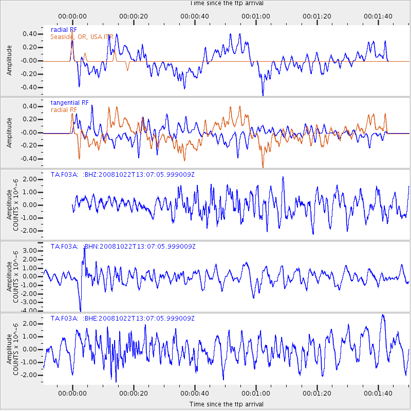
F03A Seaside, OR, USA - Earthquake Result Viewer
*The percent match for this event was below the threshold and hence no stack was calculated.
| Earthquake location: |
Tonga Islands |
| Earthquake latitude/longitude: |
-18.4/-175.4 |
| Earthquake time(UTC): |
2008/10/22 (296) 12:55:57 GMT |
| Earthquake Depth: |
233 km |
| Earthquake Magnitude: |
5.9 MB, 6.4 MW, 6.3 MW |
| Earthquake Catalog/Contributor: |
WHDF/NEIC |
|
| Network: |
TA USArray Transportable Network (new EarthScope stations) |
| Station: |
F03A Seaside, OR, USA |
| Lat/Lon: |
45.93 N/123.56 W |
| Elevation: |
325 m |
|
| Distance: |
79.3 deg |
| Az: |
33.921 deg |
| Baz: |
229.388 deg |
| Ray Param: |
$rayparam |
*The percent match for this event was below the threshold and hence was not used in the summary stack. |
|
| Radial Match: |
62.626274 % |
| Radial Bump: |
400 |
| Transverse Match: |
60.421326 % |
| Transverse Bump: |
400 |
| SOD ConfigId: |
2560 |
| Insert Time: |
2010-03-06 09:56:49.441 +0000 |
| GWidth: |
2.5 |
| Max Bumps: |
400 |
| Tol: |
0.001 |
|
Signal To Noise
| Channel | StoN | STA | LTA |
| TA:F03A: :BHN:20081022T13:07:05.999009Z | 4.261024 | 1.6570806E-6 | 3.8889257E-7 |
| TA:F03A: :BHE:20081022T13:07:05.999009Z | 1.7408897 | 1.0934863E-6 | 6.281192E-7 |
| TA:F03A: :BHZ:20081022T13:07:05.999009Z | 2.026199 | 6.7198476E-7 | 3.3164795E-7 |
| Arrivals |
| Ps | |
| PpPs | |
| PsPs/PpSs | |


