You are here: Home > Network List > TA - USArray Transportable Network (new EarthScope stations) Stations List
> Station F03A Seaside, OR, USA > Earthquake Result Viewer
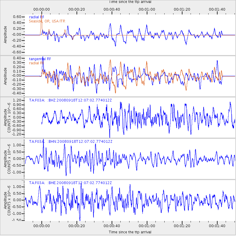
F03A Seaside, OR, USA - Earthquake Result Viewer
*The percent match for this event was below the threshold and hence no stack was calculated.
| Earthquake location: |
Near East Coast Of Kamchatka |
| Earthquake latitude/longitude: |
51.9/158.4 |
| Earthquake time(UTC): |
2008/09/18 (262) 11:58:50 GMT |
| Earthquake Depth: |
67 km |
| Earthquake Magnitude: |
5.7 MB, 5.9 MW, 5.8 MW |
| Earthquake Catalog/Contributor: |
WHDF/NEIC |
|
| Network: |
TA USArray Transportable Network (new EarthScope stations) |
| Station: |
F03A Seaside, OR, USA |
| Lat/Lon: |
45.93 N/123.56 W |
| Elevation: |
325 m |
|
| Distance: |
49.3 deg |
| Az: |
64.198 deg |
| Baz: |
306.975 deg |
| Ray Param: |
$rayparam |
*The percent match for this event was below the threshold and hence was not used in the summary stack. |
|
| Radial Match: |
52.322994 % |
| Radial Bump: |
400 |
| Transverse Match: |
59.405502 % |
| Transverse Bump: |
400 |
| SOD ConfigId: |
2504 |
| Insert Time: |
2010-03-06 09:56:53.288 +0000 |
| GWidth: |
2.5 |
| Max Bumps: |
400 |
| Tol: |
0.001 |
|
Signal To Noise
| Channel | StoN | STA | LTA |
| TA:F03A: :BHN:20080918T12:07:02.774012Z | 2.7486243 | 5.519907E-7 | 2.0082435E-7 |
| TA:F03A: :BHE:20080918T12:07:02.774012Z | 2.0872202 | 5.391207E-7 | 2.5829604E-7 |
| TA:F03A: :BHZ:20080918T12:07:02.774012Z | 1.3404197 | 3.6761466E-7 | 2.742534E-7 |
| Arrivals |
| Ps | |
| PpPs | |
| PsPs/PpSs | |


