You are here: Home > Network List > TA - USArray Transportable Network (new EarthScope stations) Stations List
> Station 528A Cox Ranch, Sanderson, TX, USA > Earthquake Result Viewer
528A Cox Ranch, Sanderson, TX, USA - Earthquake Result Viewer

| Earthquake location: |
Peru-Brazil Border Region |
| Earthquake latitude/longitude: |
-7.6/-74.4 |
| Earthquake time(UTC): |
2008/08/26 (239) 21:00:36 GMT |
| Earthquake Depth: |
154 km |
| Earthquake Magnitude: |
6.0 MB, 6.4 MW, 6.4 MW |
| Earthquake Catalog/Contributor: |
WHDF/NEIC |
|
| Network: |
TA USArray Transportable Network (new EarthScope stations) |
| Station: |
528A Cox Ranch, Sanderson, TX, USA |
| Lat/Lon: |
30.16 N/102.79 W |
| Elevation: |
1183 m |
|
| Distance: |
46.4 deg |
| Az: |
325.347 deg |
| Baz: |
139.4 deg |
| Ray Param: |
0.07007165 |
| Estimated Moho Depth: |
23.0 km |
| Estimated Crust Vp/Vs: |
1.96 |
| Assumed Crust Vp: |
6.121 km/s |
| Estimated Crust Vs: |
3.127 km/s |
| Estimated Crust Poisson's Ratio: |
0.32 |
|
| Radial Match: |
95.114815 % |
| Radial Bump: |
300 |
| Transverse Match: |
81.99029 % |
| Transverse Bump: |
400 |
| SOD ConfigId: |
2504 |
| Insert Time: |
2010-03-06 09:57:10.380 +0000 |
| GWidth: |
2.5 |
| Max Bumps: |
400 |
| Tol: |
0.001 |
|
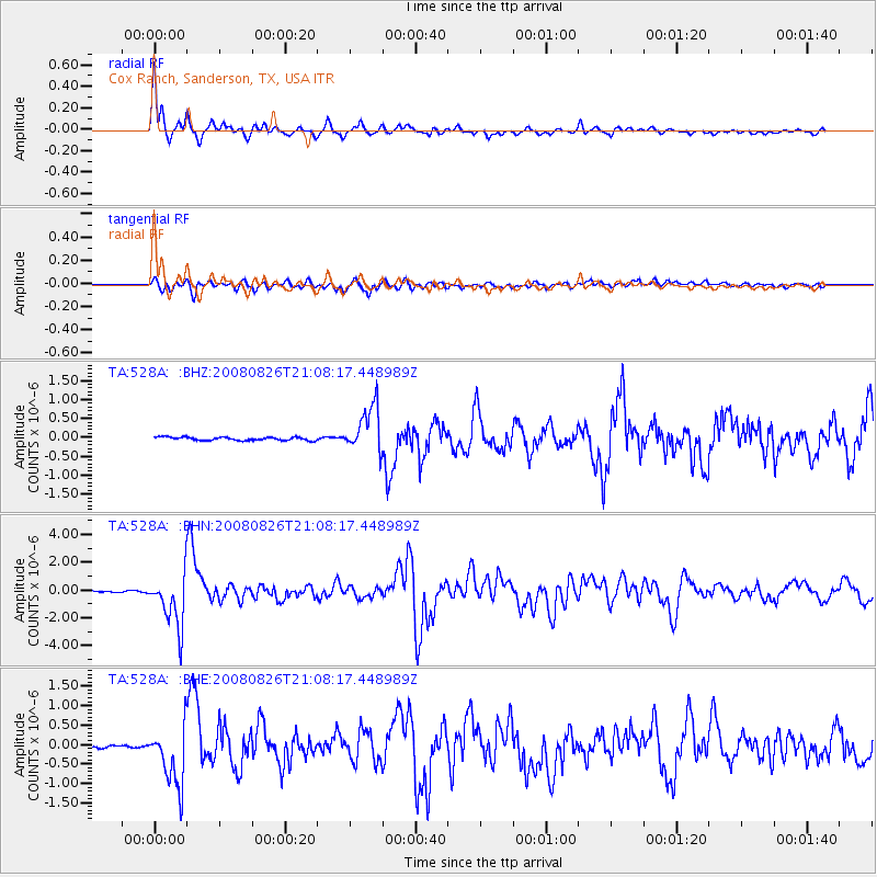
Signal To Noise
| Channel | StoN | STA | LTA |
| TA:528A: :BHN:20080826T21:08:17.448989Z | 30.903559 | 1.9088193E-6 | 6.176697E-8 |
| TA:528A: :BHE:20080826T21:08:17.448989Z | 20.072914 | 7.817318E-7 | 3.894461E-8 |
| TA:528A: :BHZ:20080826T21:08:17.448989Z | 13.949486 | 6.0558665E-7 | 4.3412832E-8 |
| Arrivals |
| Ps | 3.8 SECOND |
| PpPs | 11 SECOND |
| PsPs/PpSs | 14 SECOND |


