You are here: Home > Network List > CI - Caltech Regional Seismic Network Stations List
> Station JCS Julian Camp Stevens, California, USA > Earthquake Result Viewer
JCS Julian Camp Stevens, California, USA - Earthquake Result Viewer

| Earthquake location: |
Kuril Islands |
| Earthquake latitude/longitude: |
44.3/148.4 |
| Earthquake time(UTC): |
2001/05/25 (145) 00:40:50 GMT |
| Earthquake Depth: |
33 km |
| Earthquake Magnitude: |
6.1 MB, 6.7 MS, 6.7 MW, 6.6 MW |
| Earthquake Catalog/Contributor: |
WHDF/NEIC |
|
| Network: |
CI Caltech Regional Seismic Network |
| Station: |
JCS Julian Camp Stevens, California, USA |
| Lat/Lon: |
33.09 N/116.60 W |
| Elevation: |
1258 m |
|
| Distance: |
71.0 deg |
| Az: |
62.178 deg |
| Baz: |
310.815 deg |
| Ray Param: |
0.05454817 |
| Estimated Moho Depth: |
26.75 km |
| Estimated Crust Vp/Vs: |
2.01 |
| Assumed Crust Vp: |
6.264 km/s |
| Estimated Crust Vs: |
3.12 km/s |
| Estimated Crust Poisson's Ratio: |
0.33 |
|
| Radial Match: |
91.89654 % |
| Radial Bump: |
400 |
| Transverse Match: |
74.44496 % |
| Transverse Bump: |
400 |
| SOD ConfigId: |
3770 |
| Insert Time: |
2010-02-26 01:52:38.649 +0000 |
| GWidth: |
2.5 |
| Max Bumps: |
400 |
| Tol: |
0.001 |
|
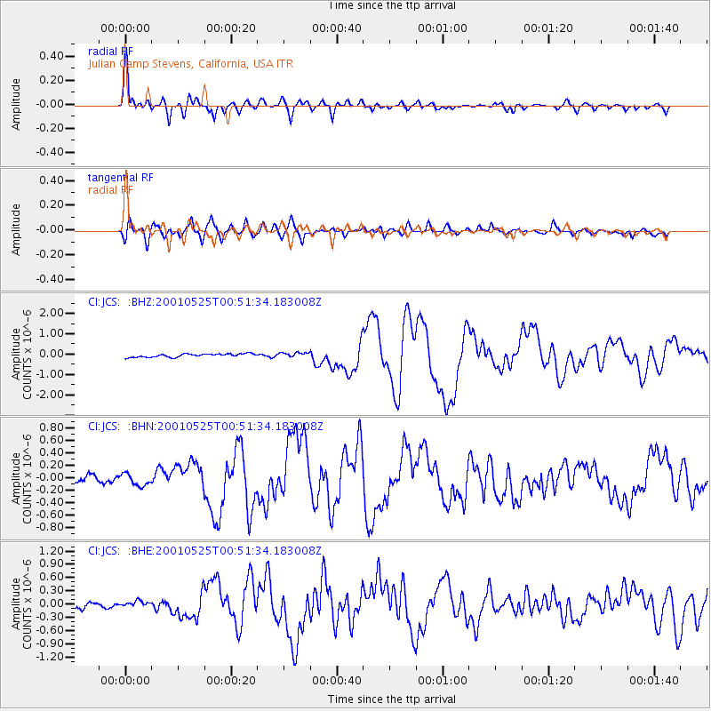
Signal To Noise
| Channel | StoN | STA | LTA |
| CI:JCS: :BHN:20010525T00:51:34.183008Z | 1.2025021 | 9.56065E-8 | 7.95063E-8 |
| CI:JCS: :BHE:20010525T00:51:34.183008Z | 1.430071 | 8.752753E-8 | 6.120502E-8 |
| CI:JCS: :BHZ:20010525T00:51:34.183008Z | 1.3612089 | 1.11666495E-7 | 8.2034795E-8 |
| Arrivals |
| Ps | 4.4 SECOND |
| PpPs | 12 SECOND |
| PsPs/PpSs | 17 SECOND |


