You are here: Home > Network List > CI - Caltech Regional Seismic Network Stations List
> Station MPM Manuel Prospect Mine, California, USA > Earthquake Result Viewer
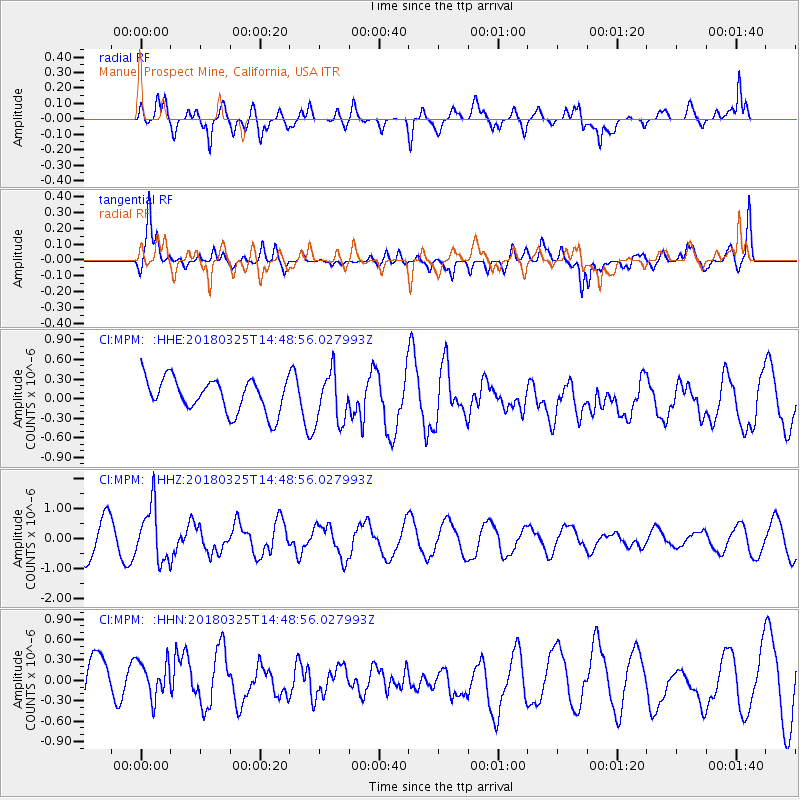
MPM Manuel Prospect Mine, California, USA - Earthquake Result Viewer
*The percent match for this event was below the threshold and hence no stack was calculated.
| Earthquake location: |
Southeast Of Honshu, Japan |
| Earthquake latitude/longitude: |
32.6/140.6 |
| Earthquake time(UTC): |
2018/03/25 (084) 14:37:23 GMT |
| Earthquake Depth: |
51 km |
| Earthquake Magnitude: |
5.7 Mww |
| Earthquake Catalog/Contributor: |
NEIC PDE/us |
|
| Network: |
CI Caltech Regional Seismic Network |
| Station: |
MPM Manuel Prospect Mine, California, USA |
| Lat/Lon: |
36.06 N/117.49 W |
| Elevation: |
185 m |
|
| Distance: |
80.0 deg |
| Az: |
53.631 deg |
| Baz: |
302.987 deg |
| Ray Param: |
$rayparam |
*The percent match for this event was below the threshold and hence was not used in the summary stack. |
|
| Radial Match: |
64.13787 % |
| Radial Bump: |
400 |
| Transverse Match: |
67.94043 % |
| Transverse Bump: |
400 |
| SOD ConfigId: |
13570011 |
| Insert Time: |
2019-04-30 00:19:49.118 +0000 |
| GWidth: |
2.5 |
| Max Bumps: |
400 |
| Tol: |
0.001 |
|
Signal To Noise
| Channel | StoN | STA | LTA |
| CI:MPM: :HHZ:20180325T14:48:56.027993Z | 1.676722 | 9.0842707E-7 | 5.4178753E-7 |
| CI:MPM: :HHN:20180325T14:48:56.027993Z | 1.0811396 | 2.8825912E-7 | 2.6662525E-7 |
| CI:MPM: :HHE:20180325T14:48:56.027993Z | 1.4713261 | 3.763197E-7 | 2.5576907E-7 |
| Arrivals |
| Ps | |
| PpPs | |
| PsPs/PpSs | |


