You are here: Home > Network List > CN - Canadian National Seismograph Network Stations List
> Station INK INUVIK, NT > Earthquake Result Viewer
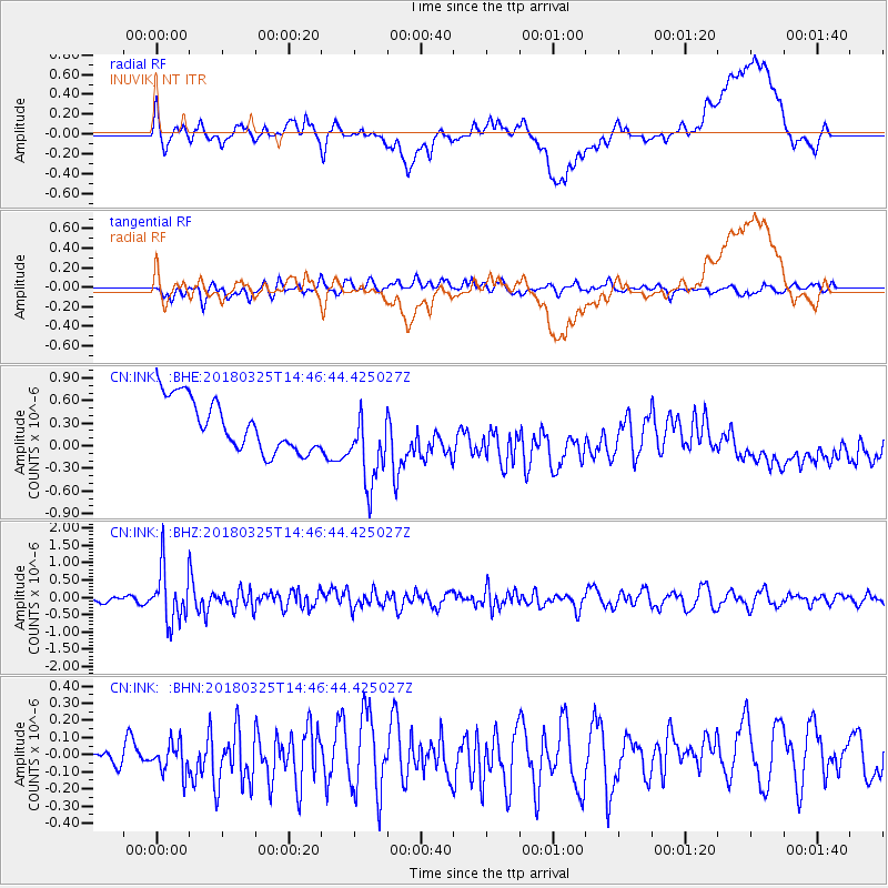
INK INUVIK, NT - Earthquake Result Viewer
*The percent match for this event was below the threshold and hence no stack was calculated.
| Earthquake location: |
Southeast Of Honshu, Japan |
| Earthquake latitude/longitude: |
32.6/140.6 |
| Earthquake time(UTC): |
2018/03/25 (084) 14:37:23 GMT |
| Earthquake Depth: |
51 km |
| Earthquake Magnitude: |
5.7 Mww |
| Earthquake Catalog/Contributor: |
NEIC PDE/us |
|
| Network: |
CN Canadian National Seismograph Network |
| Station: |
INK INUVIK, NT |
| Lat/Lon: |
68.31 N/133.53 W |
| Elevation: |
44 m |
|
| Distance: |
58.6 deg |
| Az: |
25.741 deg |
| Baz: |
279.597 deg |
| Ray Param: |
$rayparam |
*The percent match for this event was below the threshold and hence was not used in the summary stack. |
|
| Radial Match: |
34.724 % |
| Radial Bump: |
400 |
| Transverse Match: |
64.85534 % |
| Transverse Bump: |
400 |
| SOD ConfigId: |
13570011 |
| Insert Time: |
2019-04-30 00:20:20.968 +0000 |
| GWidth: |
2.5 |
| Max Bumps: |
400 |
| Tol: |
0.001 |
|
Signal To Noise
| Channel | StoN | STA | LTA |
| CN:INK: :BHZ:20180325T14:46:44.425027Z | 6.328771 | 7.797406E-7 | 1.232057E-7 |
| CN:INK: :BHN:20180325T14:46:44.425027Z | 1.8010385 | 9.199892E-8 | 5.1081038E-8 |
| CN:INK: :BHE:20180325T14:46:44.425027Z | 1.62328 | 5.4930615E-7 | 3.383927E-7 |
| Arrivals |
| Ps | |
| PpPs | |
| PsPs/PpSs | |


