You are here: Home > Network List > TA - USArray Transportable Network (new EarthScope stations) Stations List
> Station F21K Alatna River, AK, USA > Earthquake Result Viewer
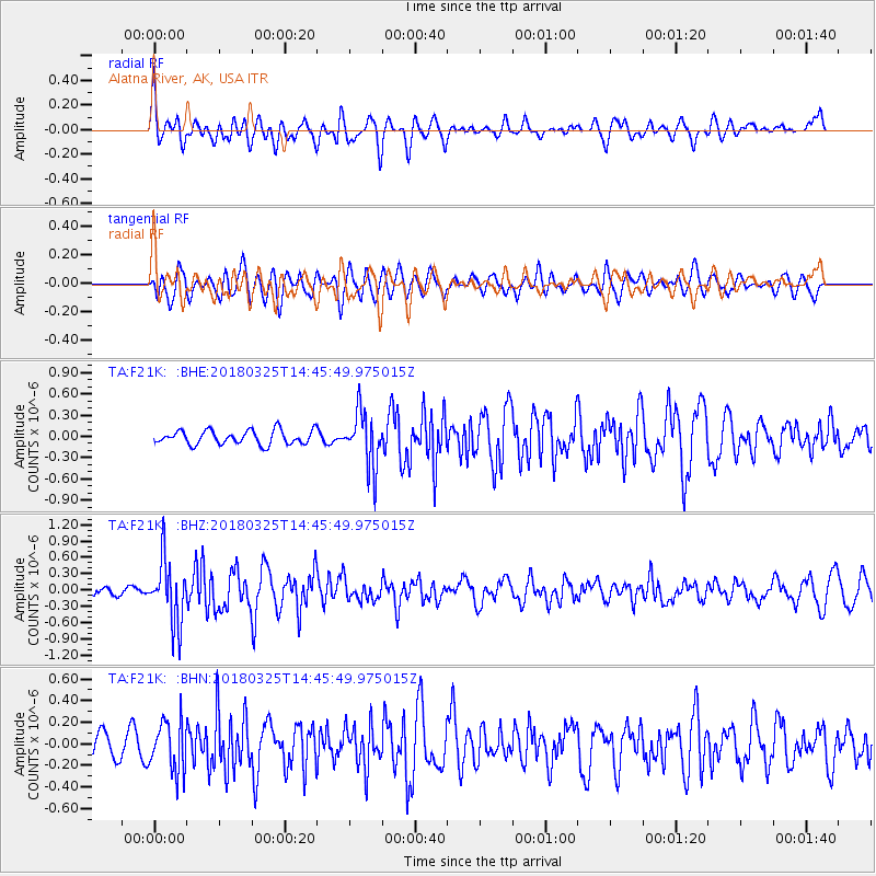
F21K Alatna River, AK, USA - Earthquake Result Viewer
*The percent match for this event was below the threshold and hence no stack was calculated.
| Earthquake location: |
Southeast Of Honshu, Japan |
| Earthquake latitude/longitude: |
32.6/140.6 |
| Earthquake time(UTC): |
2018/03/25 (084) 14:37:23 GMT |
| Earthquake Depth: |
51 km |
| Earthquake Magnitude: |
5.7 Mww |
| Earthquake Catalog/Contributor: |
NEIC PDE/us |
|
| Network: |
TA USArray Transportable Network (new EarthScope stations) |
| Station: |
F21K Alatna River, AK, USA |
| Lat/Lon: |
67.22 N/153.48 W |
| Elevation: |
597 m |
|
| Distance: |
51.1 deg |
| Az: |
27.177 deg |
| Baz: |
261.942 deg |
| Ray Param: |
$rayparam |
*The percent match for this event was below the threshold and hence was not used in the summary stack. |
|
| Radial Match: |
49.617085 % |
| Radial Bump: |
400 |
| Transverse Match: |
55.688652 % |
| Transverse Bump: |
400 |
| SOD ConfigId: |
13570011 |
| Insert Time: |
2019-04-30 00:25:02.681 +0000 |
| GWidth: |
2.5 |
| Max Bumps: |
400 |
| Tol: |
0.001 |
|
Signal To Noise
| Channel | StoN | STA | LTA |
| TA:F21K: :BHZ:20180325T14:45:49.975015Z | 3.9475365 | 5.836874E-7 | 1.4786119E-7 |
| TA:F21K: :BHN:20180325T14:45:49.975015Z | 1.2239861 | 2.3268097E-7 | 1.9010098E-7 |
| TA:F21K: :BHE:20180325T14:45:49.975015Z | 3.9814777 | 3.9538395E-7 | 9.930583E-8 |
| Arrivals |
| Ps | |
| PpPs | |
| PsPs/PpSs | |


