You are here: Home > Network List > TA - USArray Transportable Network (new EarthScope stations) Stations List
> Station I30M Mount Dempster, Yukon, CAN > Earthquake Result Viewer
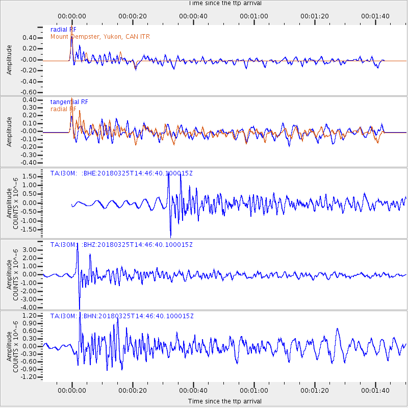
I30M Mount Dempster, Yukon, CAN - Earthquake Result Viewer
*The percent match for this event was below the threshold and hence no stack was calculated.
| Earthquake location: |
Southeast Of Honshu, Japan |
| Earthquake latitude/longitude: |
32.6/140.6 |
| Earthquake time(UTC): |
2018/03/25 (084) 14:37:23 GMT |
| Earthquake Depth: |
51 km |
| Earthquake Magnitude: |
5.7 Mww |
| Earthquake Catalog/Contributor: |
NEIC PDE/us |
|
| Network: |
TA USArray Transportable Network (new EarthScope stations) |
| Station: |
I30M Mount Dempster, Yukon, CAN |
| Lat/Lon: |
65.22 N/136.38 W |
| Elevation: |
1399 m |
|
| Distance: |
58.0 deg |
| Az: |
29.547 deg |
| Baz: |
278.979 deg |
| Ray Param: |
$rayparam |
*The percent match for this event was below the threshold and hence was not used in the summary stack. |
|
| Radial Match: |
60.007637 % |
| Radial Bump: |
400 |
| Transverse Match: |
71.06932 % |
| Transverse Bump: |
400 |
| SOD ConfigId: |
13570011 |
| Insert Time: |
2019-04-30 00:25:45.263 +0000 |
| GWidth: |
2.5 |
| Max Bumps: |
400 |
| Tol: |
0.001 |
|
Signal To Noise
| Channel | StoN | STA | LTA |
| TA:I30M: :BHZ:20180325T14:46:40.100015Z | 9.374917 | 1.4253112E-6 | 1.5203453E-7 |
| TA:I30M: :BHN:20180325T14:46:40.100015Z | 2.990677 | 4.3361166E-7 | 1.4498778E-7 |
| TA:I30M: :BHE:20180325T14:46:40.100015Z | 4.9608884 | 6.5657474E-7 | 1.3235024E-7 |
| Arrivals |
| Ps | |
| PpPs | |
| PsPs/PpSs | |


