You are here: Home > Network List > UW - Pacific Northwest Regional Seismic Network Stations List
> Station UMAT Pilot Rock, OR, USA > Earthquake Result Viewer
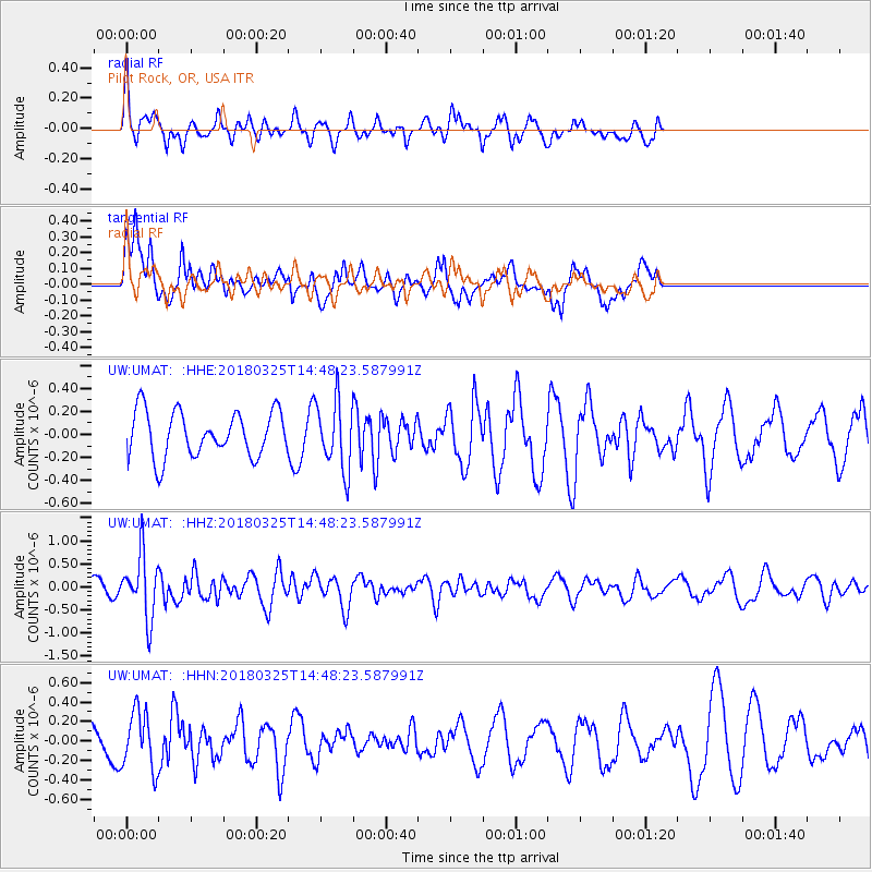
UMAT Pilot Rock, OR, USA - Earthquake Result Viewer
*The percent match for this event was below the threshold and hence no stack was calculated.
| Earthquake location: |
Southeast Of Honshu, Japan |
| Earthquake latitude/longitude: |
32.6/140.6 |
| Earthquake time(UTC): |
2018/03/25 (084) 14:37:23 GMT |
| Earthquake Depth: |
51 km |
| Earthquake Magnitude: |
5.7 Mww |
| Earthquake Catalog/Contributor: |
NEIC PDE/us |
|
| Network: |
UW Pacific Northwest Regional Seismic Network |
| Station: |
UMAT Pilot Rock, OR, USA |
| Lat/Lon: |
45.29 N/118.96 W |
| Elevation: |
1318 m |
|
| Distance: |
74.2 deg |
| Az: |
46.185 deg |
| Baz: |
300.362 deg |
| Ray Param: |
$rayparam |
*The percent match for this event was below the threshold and hence was not used in the summary stack. |
|
| Radial Match: |
45.50206 % |
| Radial Bump: |
319 |
| Transverse Match: |
62.330006 % |
| Transverse Bump: |
400 |
| SOD ConfigId: |
13570011 |
| Insert Time: |
2019-04-30 00:28:02.317 +0000 |
| GWidth: |
2.5 |
| Max Bumps: |
400 |
| Tol: |
0.001 |
|
Signal To Noise
| Channel | StoN | STA | LTA |
| UW:UMAT: :HHZ:20180325T14:48:23.587991Z | 4.126989 | 6.779032E-7 | 1.6426097E-7 |
| UW:UMAT: :HHN:20180325T14:48:23.587991Z | 2.0127203 | 2.958492E-7 | 1.4698972E-7 |
| UW:UMAT: :HHE:20180325T14:48:23.587991Z | 1.5362108 | 3.0135195E-7 | 1.9616577E-7 |
| Arrivals |
| Ps | |
| PpPs | |
| PsPs/PpSs | |


