You are here: Home > Network List > TA - USArray Transportable Network (new EarthScope stations) Stations List
> Station A21K Barrow, AK, USA > Earthquake Result Viewer
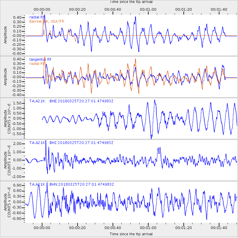
A21K Barrow, AK, USA - Earthquake Result Viewer
*The percent match for this event was below the threshold and hence no stack was calculated.
| Earthquake location: |
Banda Sea |
| Earthquake latitude/longitude: |
-6.7/129.9 |
| Earthquake time(UTC): |
2018/03/25 (084) 20:14:47 GMT |
| Earthquake Depth: |
172 km |
| Earthquake Magnitude: |
6.4 Mww |
| Earthquake Catalog/Contributor: |
NEIC PDE/us |
|
| Network: |
TA USArray Transportable Network (new EarthScope stations) |
| Station: |
A21K Barrow, AK, USA |
| Lat/Lon: |
71.32 N/156.62 W |
| Elevation: |
577 m |
|
| Distance: |
91.0 deg |
| Az: |
17.999 deg |
| Baz: |
252.304 deg |
| Ray Param: |
$rayparam |
*The percent match for this event was below the threshold and hence was not used in the summary stack. |
|
| Radial Match: |
68.18681 % |
| Radial Bump: |
323 |
| Transverse Match: |
50.843967 % |
| Transverse Bump: |
389 |
| SOD ConfigId: |
13570011 |
| Insert Time: |
2019-04-30 00:31:41.144 +0000 |
| GWidth: |
2.5 |
| Max Bumps: |
400 |
| Tol: |
0.001 |
|
Signal To Noise
| Channel | StoN | STA | LTA |
| TA:A21K: :BHZ:20180325T20:27:01.474983Z | 5.202057 | 7.387606E-7 | 1.4201316E-7 |
| TA:A21K: :BHN:20180325T20:27:01.474983Z | 1.4728798 | 5.314953E-7 | 3.608545E-7 |
| TA:A21K: :BHE:20180325T20:27:01.474983Z | 1.6930329 | 3.5231585E-7 | 2.0809748E-7 |
| Arrivals |
| Ps | |
| PpPs | |
| PsPs/PpSs | |


