Z25A Roswell, NM, USA - Earthquake Result Viewer
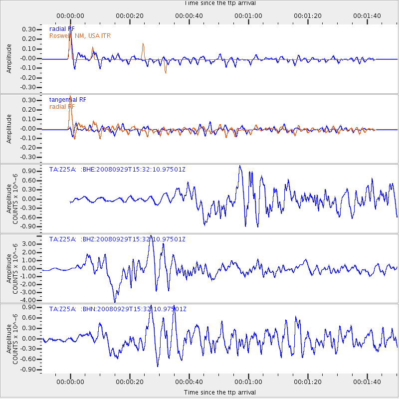
Earthquake location: Kermadec Islands, New Zealand
Earthquake latitude/longitude: -29.8/-177.7
Earthquake time(UTC): 2008/09/29 (273) 15:19:31 GMT
Earthquake Depth: 36 km
Earthquake Magnitude: 6.5 MB, 6.7 MS, 7.0 MW, 7.0 MW
Earthquake Catalog/Contributor: WHDF/NEIC
Network: TA USArray Transportable Network (new EarthScope stations)
Station: Z25A Roswell, NM, USA
Lat/Lon: 33.28 N/104.72 W
Elevation: 1233 m
Distance: 93.2 deg
Az: 53.342 deg
Baz: 236.382 deg
Ray Param: 0.041289814
Estimated Moho Depth: 16.25 km
Estimated Crust Vp/Vs: 1.97
Assumed Crust Vp: 6.232 km/s
Estimated Crust Vs: 3.167 km/s
Estimated Crust Poisson's Ratio: 0.33
Radial Match: 95.42537 %
Radial Bump: 400
Transverse Match: 84.418976 %
Transverse Bump: 400
SOD ConfigId: 2560
Insert Time: 2010-03-06 10:02:14.398 +0000
GWidth: 2.5
Max Bumps: 400
Tol: 0.001

Signal To Noise

ChannelStoNSTALTA
TA:Z25A: :BHZ:20080929T15:32:10.97501Z3.00937533.2089994E-71.066334E-7
TA:Z25A: :BHN:20080929T15:32:10.97501Z1.28640788.01005E-86.22668E-8
TA:Z25A: :BHE:20080929T15:32:10.97501Z2.40202161.3098037E-75.4529217E-8
Arrivals
Ps2.6 SECOND
PpPs7.6 SECOND
PsPs/PpSs10 SECOND