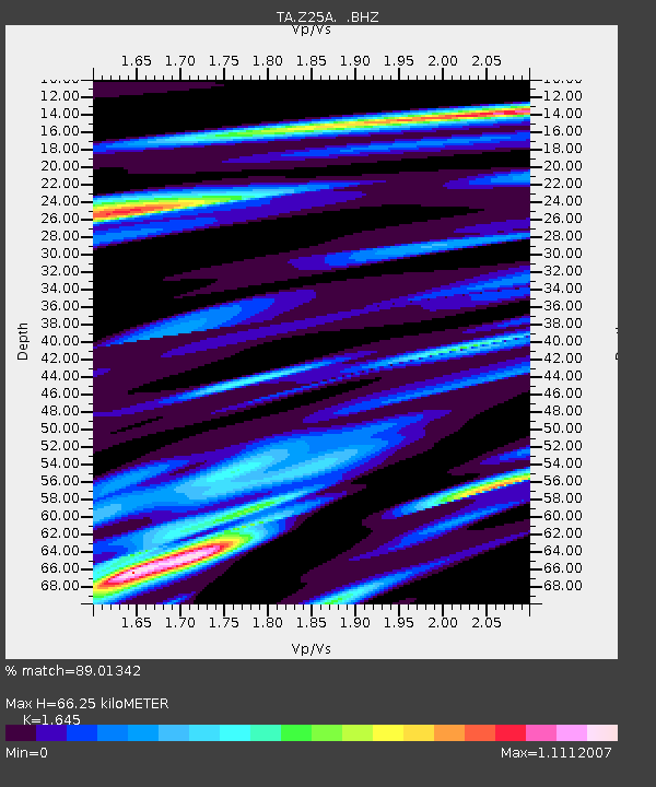
Z25A Roswell, NM, USA - Earthquake Result Viewer
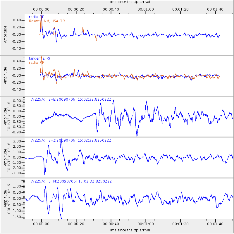
Earthquake location: Rat Islands, Aleutian Islands
Earthquake latitude/longitude: 50.4/177.0
Earthquake time(UTC): 2009/07/06 (187) 14:53:12 GMT
Earthquake Depth: 22 km
Earthquake Magnitude: 6.0 MB, 5.8 MS, 6.1 MW, 6.0 MW
Earthquake Catalog/Contributor: WHDF/NEIC
Network: TA USArray Transportable Network (new EarthScope stations)
Station: Z25A Roswell, NM, USA
Lat/Lon: 33.28 N/104.72 W
Elevation: 1233 m
Distance: 58.1 deg
Az: 75.08 deg
Baz: 312.467 deg
Ray Param: 0.06304322
Estimated Moho Depth: 66.25 km
Estimated Crust Vp/Vs: 1.64
Assumed Crust Vp: 6.232 km/s
Estimated Crust Vs: 3.788 km/s
Estimated Crust Poisson's Ratio: 0.21
Radial Match: 89.01342 %
Radial Bump: 400
Transverse Match: 76.68993 %
Transverse Bump: 400
SOD ConfigId: 2648
Insert Time: 2010-03-06 10:03:06.786 +0000
GWidth: 2.5
Max Bumps: 400
Tol: 0.001

Signal To Noise

ChannelStoNSTALTA
TA:Z25A: :BHZ:20090706T15:02:32.825022Z9.8537731.4021595E-61.422967E-7
TA:Z25A: :BHN:20090706T15:02:32.825022Z5.34206255.941468E-71.1122049E-7
TA:Z25A: :BHE:20090706T15:02:32.825022Z3.13460924.4042034E-71.4050248E-7
Arrivals
Ps7.2 SECOND
PpPs27 SECOND
PsPs/PpSs34 SECOND