
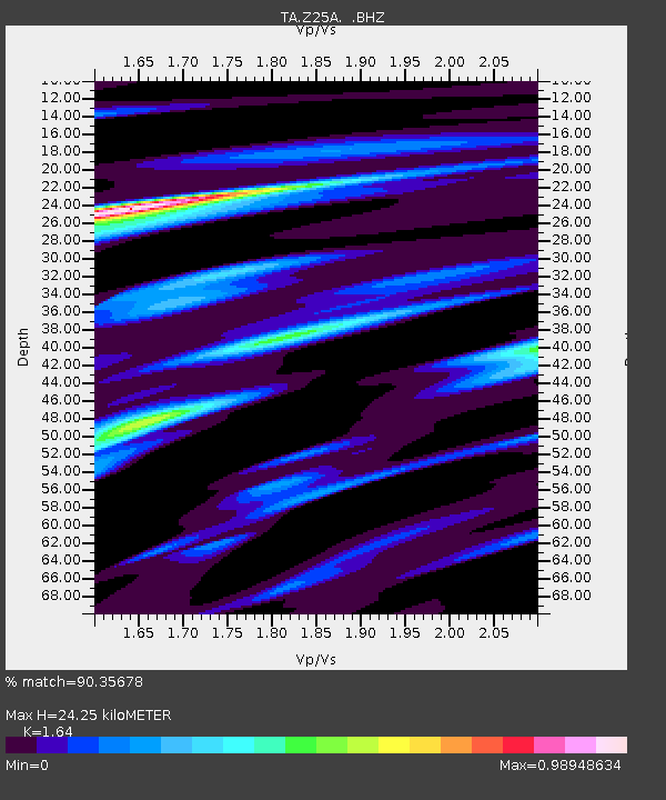
Z25A Roswell, NM, USA - Earthquake Result Viewer
| ||||||||||||||||||
| ||||||||||||||||||
| ||||||||||||||||||
|
Signal To Noise
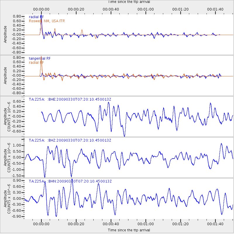
| Channel | StoN | STA | LTA |
| TA:Z25A: :BHZ:20090330T07:20:10.450013Z | 3.2071323 | 7.6154316E-7 | 2.3745298E-7 |
| TA:Z25A: :BHN:20090330T07:20:10.450013Z | 5.559879 | 4.8212456E-7 | 8.671494E-8 |
| TA:Z25A: :BHE:20090330T07:20:10.450013Z | 1.9563264 | 3.0911883E-7 | 1.5800984E-7 |
| Arrivals | |
| Ps | 2.7 SECOND |
| PpPs | 9.6 SECOND |
| PsPs/PpSs | 12 SECOND |

