You are here: Home > Network List > TA - USArray Transportable Network (new EarthScope stations) Stations List
> Station Z25A Roswell, NM, USA > Earthquake Result Viewer
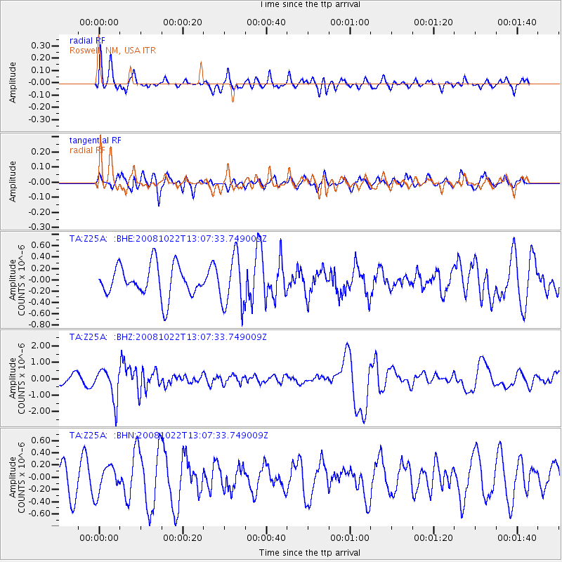
Z25A Roswell, NM, USA - Earthquake Result Viewer
*The percent match for this event was below the threshold and hence no stack was calculated.
| Earthquake location: |
Tonga Islands |
| Earthquake latitude/longitude: |
-18.4/-175.4 |
| Earthquake time(UTC): |
2008/10/22 (296) 12:55:57 GMT |
| Earthquake Depth: |
233 km |
| Earthquake Magnitude: |
5.9 MB, 6.4 MW, 6.3 MW |
| Earthquake Catalog/Contributor: |
WHDF/NEIC |
|
| Network: |
TA USArray Transportable Network (new EarthScope stations) |
| Station: |
Z25A Roswell, NM, USA |
| Lat/Lon: |
33.28 N/104.72 W |
| Elevation: |
1233 m |
|
| Distance: |
84.7 deg |
| Az: |
52.53 deg |
| Baz: |
244.099 deg |
| Ray Param: |
$rayparam |
*The percent match for this event was below the threshold and hence was not used in the summary stack. |
|
| Radial Match: |
66.124344 % |
| Radial Bump: |
400 |
| Transverse Match: |
35.471684 % |
| Transverse Bump: |
375 |
| SOD ConfigId: |
2560 |
| Insert Time: |
2010-03-06 10:04:20.165 +0000 |
| GWidth: |
2.5 |
| Max Bumps: |
400 |
| Tol: |
0.001 |
|
Signal To Noise
| Channel | StoN | STA | LTA |
| TA:Z25A: :BHZ:20081022T13:07:33.749009Z | 4.665918 | 1.000375E-6 | 2.1440049E-7 |
| TA:Z25A: :BHN:20081022T13:07:33.749009Z | 1.069213 | 2.1783956E-7 | 2.0373821E-7 |
| TA:Z25A: :BHE:20081022T13:07:33.749009Z | 1.6940217 | 4.620324E-7 | 2.727429E-7 |
| Arrivals |
| Ps | |
| PpPs | |
| PsPs/PpSs | |


