You are here: Home > Network List > TA - USArray Transportable Network (new EarthScope stations) Stations List
> Station Z25A Roswell, NM, USA > Earthquake Result Viewer
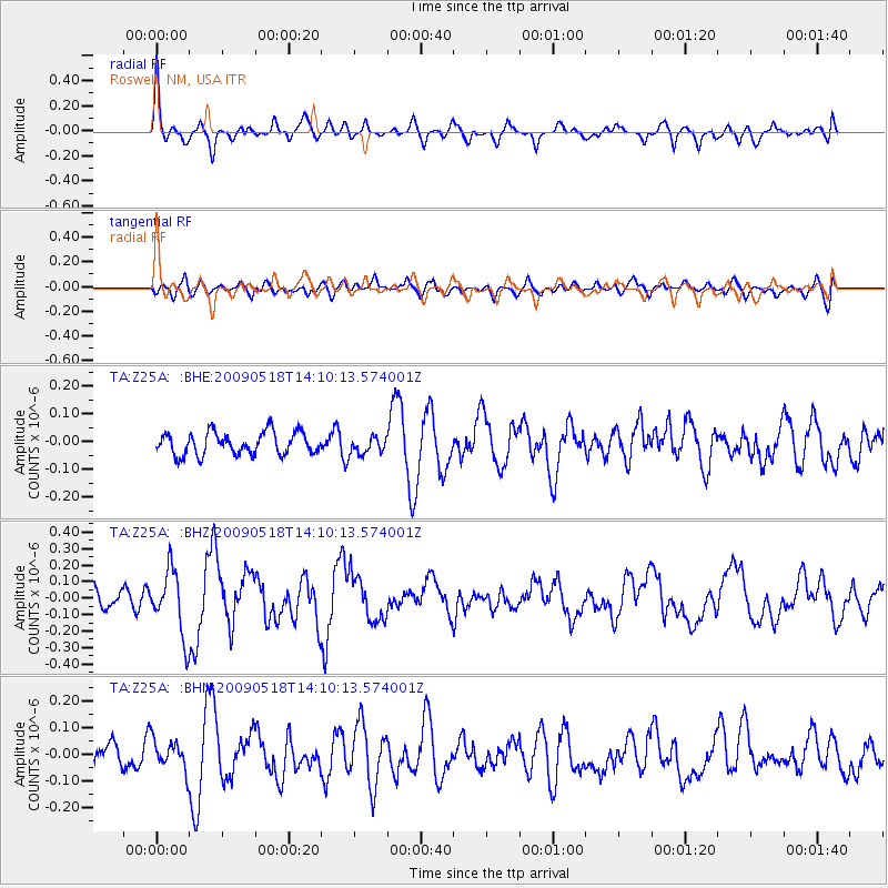
Z25A Roswell, NM, USA - Earthquake Result Viewer
*The percent match for this event was below the threshold and hence no stack was calculated.
| Earthquake location: |
Near Coast Of Peru |
| Earthquake latitude/longitude: |
-15.7/-74.8 |
| Earthquake time(UTC): |
2009/05/18 (138) 14:01:04 GMT |
| Earthquake Depth: |
23 km |
| Earthquake Magnitude: |
5.5 MS, 5.3 MB, 5.8 MW, 5.8 MW |
| Earthquake Catalog/Contributor: |
WHDF/NEIC |
|
| Network: |
TA USArray Transportable Network (new EarthScope stations) |
| Station: |
Z25A Roswell, NM, USA |
| Lat/Lon: |
33.28 N/104.72 W |
| Elevation: |
1233 m |
|
| Distance: |
56.4 deg |
| Az: |
329.936 deg |
| Baz: |
144.822 deg |
| Ray Param: |
$rayparam |
*The percent match for this event was below the threshold and hence was not used in the summary stack. |
|
| Radial Match: |
72.81671 % |
| Radial Bump: |
400 |
| Transverse Match: |
57.235886 % |
| Transverse Bump: |
400 |
| SOD ConfigId: |
2760 |
| Insert Time: |
2010-03-06 10:04:22.428 +0000 |
| GWidth: |
2.5 |
| Max Bumps: |
400 |
| Tol: |
0.001 |
|
Signal To Noise
| Channel | StoN | STA | LTA |
| TA:Z25A: :BHZ:20090518T14:10:13.574001Z | 2.6768417 | 1.9605548E-7 | 7.324134E-8 |
| TA:Z25A: :BHN:20090518T14:10:13.574001Z | 1.2937592 | 5.554663E-8 | 4.2934282E-8 |
| TA:Z25A: :BHE:20090518T14:10:13.574001Z | 0.7626981 | 3.0701592E-8 | 4.0253923E-8 |
| Arrivals |
| Ps | |
| PpPs | |
| PsPs/PpSs | |


