You are here: Home > Network List > TA - USArray Transportable Network (new EarthScope stations) Stations List
> Station P17K Kvichak River, AK, USA > Earthquake Result Viewer
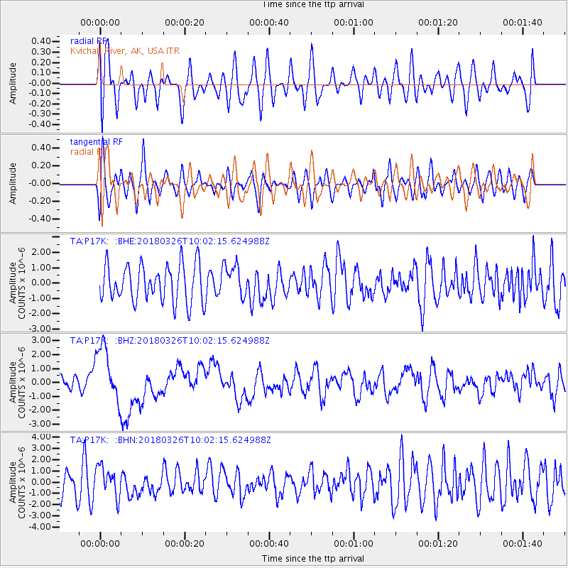
P17K Kvichak River, AK, USA - Earthquake Result Viewer
*The percent match for this event was below the threshold and hence no stack was calculated.
| Earthquake location: |
New Britain Region, P.N.G. |
| Earthquake latitude/longitude: |
-5.5/151.4 |
| Earthquake time(UTC): |
2018/03/26 (085) 09:51:00 GMT |
| Earthquake Depth: |
40 km |
| Earthquake Magnitude: |
6.6 mww |
| Earthquake Catalog/Contributor: |
NEIC PDE/us |
|
| Network: |
TA USArray Transportable Network (new EarthScope stations) |
| Station: |
P17K Kvichak River, AK, USA |
| Lat/Lon: |
59.20 N/156.44 W |
| Elevation: |
91 m |
|
| Distance: |
76.5 deg |
| Az: |
24.707 deg |
| Baz: |
233.953 deg |
| Ray Param: |
$rayparam |
*The percent match for this event was below the threshold and hence was not used in the summary stack. |
|
| Radial Match: |
47.651394 % |
| Radial Bump: |
400 |
| Transverse Match: |
51.823696 % |
| Transverse Bump: |
400 |
| SOD ConfigId: |
13570011 |
| Insert Time: |
2019-04-30 00:41:02.241 +0000 |
| GWidth: |
2.5 |
| Max Bumps: |
400 |
| Tol: |
0.001 |
|
Signal To Noise
| Channel | StoN | STA | LTA |
| TA:P17K: :BHZ:20180326T10:02:15.624988Z | 5.7761574 | 2.0702994E-6 | 3.5842157E-7 |
| TA:P17K: :BHN:20180326T10:02:15.624988Z | 1.0877624 | 1.3783127E-6 | 1.2671084E-6 |
| TA:P17K: :BHE:20180326T10:02:15.624988Z | 0.8701018 | 1.0529016E-6 | 1.2100901E-6 |
| Arrivals |
| Ps | |
| PpPs | |
| PsPs/PpSs | |


