You are here: Home > Network List > TA - USArray Transportable Network (new EarthScope stations) Stations List
> Station Z25A Roswell, NM, USA > Earthquake Result Viewer
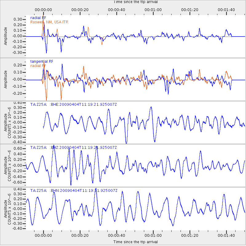
Z25A Roswell, NM, USA - Earthquake Result Viewer
*The percent match for this event was below the threshold and hence no stack was calculated.
| Earthquake location: |
Tonga Islands Region |
| Earthquake latitude/longitude: |
-22.5/-174.7 |
| Earthquake time(UTC): |
2009/04/04 (094) 11:07:12 GMT |
| Earthquake Depth: |
35 km |
| Earthquake Magnitude: |
5.5 MB, 5.4 MS, 5.5 MW, 5.5 MW |
| Earthquake Catalog/Contributor: |
WHDF/NEIC |
|
| Network: |
TA USArray Transportable Network (new EarthScope stations) |
| Station: |
Z25A Roswell, NM, USA |
| Lat/Lon: |
33.28 N/104.72 W |
| Elevation: |
1233 m |
|
| Distance: |
86.7 deg |
| Az: |
52.016 deg |
| Baz: |
240.463 deg |
| Ray Param: |
$rayparam |
*The percent match for this event was below the threshold and hence was not used in the summary stack. |
|
| Radial Match: |
71.457855 % |
| Radial Bump: |
400 |
| Transverse Match: |
69.1608 % |
| Transverse Bump: |
380 |
| SOD ConfigId: |
2658 |
| Insert Time: |
2010-03-06 10:05:48.352 +0000 |
| GWidth: |
2.5 |
| Max Bumps: |
400 |
| Tol: |
0.001 |
|
Signal To Noise
| Channel | StoN | STA | LTA |
| TA:Z25A: :BHZ:20090404T11:19:21.925007Z | 2.0561306 | 3.0507968E-7 | 1.4837563E-7 |
| TA:Z25A: :BHN:20090404T11:19:21.925007Z | 0.58870363 | 9.431413E-8 | 1.6020647E-7 |
| TA:Z25A: :BHE:20090404T11:19:21.925007Z | 0.959818 | 1.11265216E-7 | 1.1592324E-7 |
| Arrivals |
| Ps | |
| PpPs | |
| PsPs/PpSs | |


