You are here: Home > Network List > TA - USArray Transportable Network (new EarthScope stations) Stations List
> Station Z25A Roswell, NM, USA > Earthquake Result Viewer
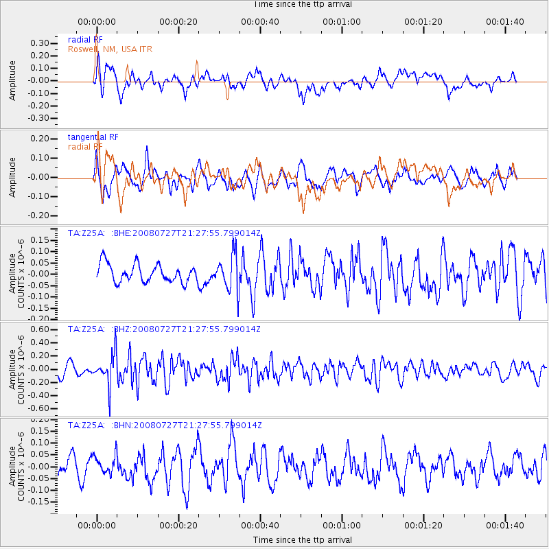
Z25A Roswell, NM, USA - Earthquake Result Viewer
*The percent match for this event was below the threshold and hence no stack was calculated.
| Earthquake location: |
Central Mid-Atlantic Ridge |
| Earthquake latitude/longitude: |
-0.3/-18.3 |
| Earthquake time(UTC): |
2008/07/27 (209) 21:15:41 GMT |
| Earthquake Depth: |
10 km |
| Earthquake Magnitude: |
5.8 MB, 5.3 MS, 5.9 MW, 5.8 MW |
| Earthquake Catalog/Contributor: |
WHDF/NEIC |
|
| Network: |
TA USArray Transportable Network (new EarthScope stations) |
| Station: |
Z25A Roswell, NM, USA |
| Lat/Lon: |
33.28 N/104.72 W |
| Elevation: |
1233 m |
|
| Distance: |
87.1 deg |
| Az: |
303.166 deg |
| Baz: |
92.171 deg |
| Ray Param: |
$rayparam |
*The percent match for this event was below the threshold and hence was not used in the summary stack. |
|
| Radial Match: |
64.289955 % |
| Radial Bump: |
400 |
| Transverse Match: |
69.07293 % |
| Transverse Bump: |
400 |
| SOD ConfigId: |
2504 |
| Insert Time: |
2010-03-06 10:06:02.179 +0000 |
| GWidth: |
2.5 |
| Max Bumps: |
400 |
| Tol: |
0.001 |
|
Signal To Noise
| Channel | StoN | STA | LTA |
| TA:Z25A: :BHZ:20080727T21:27:55.799014Z | 3.1673098 | 2.4775576E-7 | 7.8222776E-8 |
| TA:Z25A: :BHN:20080727T21:27:55.799014Z | 0.78185093 | 3.8885172E-8 | 4.9734762E-8 |
| TA:Z25A: :BHE:20080727T21:27:55.799014Z | 2.0641127 | 8.154023E-8 | 3.9503767E-8 |
| Arrivals |
| Ps | |
| PpPs | |
| PsPs/PpSs | |


